
Time zone CST (UTC-6) Elevation 184 m Local time Sunday 7:48 PM | Established November 4, 1856 ZIP codes 61250, 61254, 61277 Area 89.9 km² Population 290 (2010) | |
 | ||
Weather 1°C, Wind SE at 14 km/h, 40% Humidity | ||
Loraine Township is one of twenty-four townships in Henry County, Illinois, USA. As of the 2010 census, its population was 290 and it contained 122 housing units.
Contents
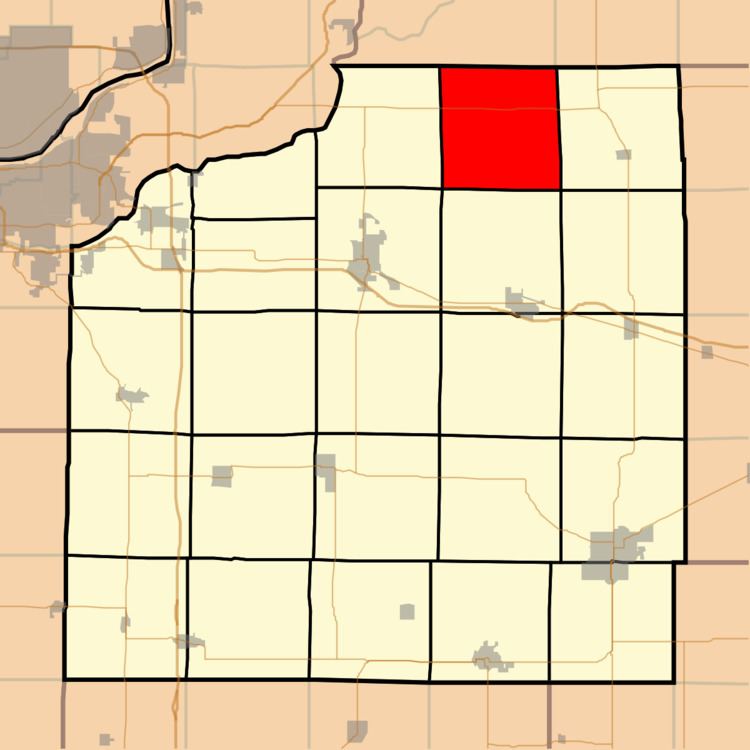
- Map of Loraine Township IL USA
- Geography
- Adjacent townships
- Cemeteries
- Major highways
- Airports and landing strips
- School districts
- Political districts
- References
Map of Loraine Township, IL, USA
Geography
According to the 2010 census, the township has a total area of 34.7 square miles (90 km2), all land.
Adjacent townships
Cemeteries
The township contains these three cemeteries: Bowman, Kemmis and Loraine.
Major highways
Airports and landing strips
School districts
Political districts
References
Loraine Township, Henry County, Illinois Wikipedia(Text) CC BY-SA