
Population 2,018 (2011) Sovereign state United Kingdom | OS grid reference SK835445 Post town NEWARK Local time Sunday 3:04 PM Dialling code 01400 | |
 | ||
Weather 13°C, Wind W at 8 km/h, 77% Humidity UK parliament constituency Sleaford and North Hykeham | ||
Long Bennington is a linear village and civil parish in South Kesteven district of Lincolnshire, England. It lies just off the A1 road, 7 miles (11 km) north of Grantham and 5 miles (8 km) south of Newark-on-Trent.
Contents
Map of Long Bennington, Newark, UK
Long Bennington has a population of 2,100, reducing to 2,018 at the 2011 Census.
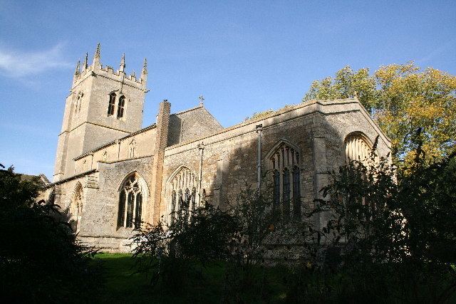
History
Long Bennington Priory was an Alien house granted in 1462 to the priory of Mount Grace. The village has connections with the Younghusband family whose members include the first western man to enter Lhasa. Long Bennington is supposed to be the last place King Harold of Wessex camped before the Battle of Hastings.
Geography
The Viking Way has passed to the south-east since 1997 to avoid a direct crossing of the A1. The River Witham runs to the east. Lying beside the A1 road, the village main street was once the part of the Great North Road from London to Edinburgh until 1968 when a bypass was constructed. It was made from concrete and made excessive road noise, but was resurfaced with tarmac in 2003 to mitigate this, at a cost of £4.4 million.
Community
Long Bennington has a parish council consisting of 11 councillors. The village is twinned with the Normandy village of Bretteville-l'Orgueilleuse. There is a Methodist chapel, St Swithun's Anglican church, and a primary school. Its public houses are the Reindeer, Royal Oak and Whittakers. The village has a football team and a bowls team.