
Country United States County Hillsborough Elevation 127 ft (39 m) Area 39.9 km² Population 8,271 (2010) | Incorporated 1734 Time zone Eastern (UTC-5) Zip code 03052 Local time Thursday 11:53 PM | |
 | ||
Weather -4°C, Wind SE at 0 km/h, 50% Humidity | ||
Litchfield is a town in Hillsborough County, New Hampshire, United States. The population was 8,271 at the 2010 census.
Contents
- Map of Litchfield NH 03052 USA
- History
- Geography
- Demographics
- Education
- Transportation
- Municipal services
- Notable people
- References
Map of Litchfield, NH 03052, USA
History
Originally known as Naticook, the name was changed to Brenton's Farm in 1729 when the land was granted to William Brenton, colonial governor of Rhode Island. The town was incorporated in 1734. After Brenton's death in 1749, the land was granted to another group of settlers and named Litchfield after George Henry Lee, Earl of Lichfield.
Wiseman Claget moved to his substantial estates here shortly before the Revolution. He was involved in the temporary government serving as the only Solicitor General, the post being abolished shortly before his death in 1784.
Geography
According to the United States Census Bureau, the town has a total area of 15.4 square miles (40 km2), of which 15.1 sq mi (39 km2) is land and 0.3 sq mi (0.78 km2) is water, comprising 2.27% of the town. The highest point in Litchfield is the summit of Rocky Hill, at 357 feet (109 m) above sea level. The town is bordered to the north by Manchester, to the east by Londonderry in Rockingham County, to the south by Hudson, and to the west by Merrimack, with the Merrimack River separating the two towns. There is no bridge connecting Litchfield and Merrimack; the closest river crossings are to the south between Nashua and Hudson, and to the north between Manchester and Bedford.
Demographics
As of the census of 2000, there were 7,360 people, 2,357 households, and 2,031 families residing in the town. The population density was 487.5 people per square mile (188.2/km²). There were 2,389 housing units at an average density of 158.3 per square mile (61.1/km²). The racial makeup of the town was 97.72% White, 0.53% African American, 0.29% Native American, 0.57% Asian, 0.15% from other races, and 0.75% from two or more races. Hispanic or Latino of any race were 0.83% of the population.
There were 2,357 households out of which 53.4% had children under the age of 18 living with them, 75.3% were married couples living together, 7.4% had a female householder with no husband present, and 13.8% were non-families. 9.5% of all households were made up of individuals and 1.4% had someone living alone who was 65 years of age or older. The average household size was 3.12 and the average family size was 3.35.
In the town, the population was spread out with 33.4% under the age of 18, 5.4% from 18 to 24, 37.8% from 25 to 44, 19.9% from 45 to 64, and 3.5% who were 65 years of age or older. The median age was 33 years. For every 100 females there were 101.1 males. For every 100 females age 18 and over, there were 98.1 males.
The median income for a household in the town was $73,302, and the median income for a family was $76,931. Males had a median income of $46,809 versus $33,488 for females. The per capita income for the town was $25,203. About 2.2% of families and 2.1% of the population were below the poverty line, including 1.6% of those under age 18 and 12.1% of those age 65 or over.
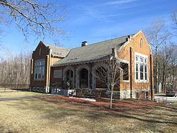
Education
There are three public schools in Litchfield:
Transportation
Two New Hampshire state highways cross Litchfield:
Though the town borders Merrimack on the west, it cannot be directly accessed as there are no bridges across the river. Access to Londonderry, to the east of Litchfield, is primarily via Hillcrest Road, which is the main east-west thoroughfare across central Litchfield.
Litchfield has no air or rail transport within the town limits. The nearest commercial airport is Manchester–Boston Regional Airport along the border of Londonderry and Manchester, which is close to the northern border of Litchfield. The nearest rail service is the Lowell Line of the MBTA Commuter Rail which can be accessed at the Charles A. Gallagher Transit Terminal in Lowell, Massachusetts. The nearest Amtrak stations are Boston's North Station or South Station.
Municipal services
The Town of Litchfield operates a waste management and transfer station on Hillcrest Road, located near the geographical center of Litchfield and the "new" town hall and police station. The historical center of Litchfield is on the Charles Bancroft Highway (New Hampshire Route 3A). Today the fire station, the first church in Litchfield and the Litchfield Historical Society are located there in and around the old town hall.
Several public parks, including Darrah Pond, Parker Park and Litchfield State Forest, are open year-round to the public.
The Litchfield Mosquito District was featured on Last Week Tonight with John Oliver. The episode featured segments from a televised town meeting from September 17, 2015, which had no members of the public in attendance.