
Location Fife, Scotland Easiest route From Fife Highest point West Lomond Mountains West Lomond, East Lomond | First ascent Unknown Elevation 461 m Listing Breast-shaped hill | |
 | ||
Similar West Lomond, Falkland Palace, Lomond Hills Regional, Benarty Hill, Hill of Tarvit | ||
The lomond hills scotland dji phantom 3 part 1 2
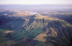
The Lomond Hills (meaning beacon hills), also known as the Paps of Fife lie in the centre of Fife, Scotland. At 522m West Lomond is the highest point in the county of Fife.
Contents
- The lomond hills scotland dji phantom 3 part 1 2
- Lomond hills mountain biking fife
- Natural geographyEdit
- HistoryEdit
- The Lomond Hills todayEdit
- References
Lomond hills mountain biking fife
Natural geographyEdit
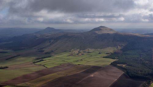
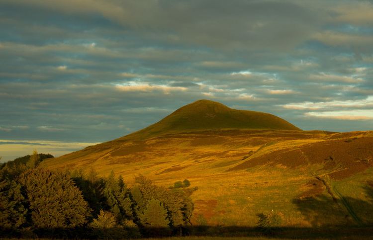
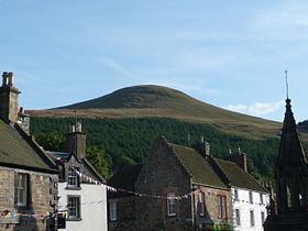
The Lomond Hills contain two prominent peaks, West Lomond and East Lomond (or Falkland Hill) (448 m), which lie at either end of an escarpment roughly 6.5 km in length. The escarpment, made from beds of sandstone, limestone and quartz-dolerite, rises gradually from the south to a plateau of around 350 m in height between the peaks of East and West Lomond. To the north and west, this plateau terminates in steep and, in places, cliffy scarp slopes. From its western end, the escarpment continues southwards beyond the deep valley of the Glen Burn (Glen Vale) to Bishop Hill (461 m). The steep-sided peaks of East and West Lomond themselves are volcanic in origin. Along the edges of the sandstone bed at the foot of the scarp slopes are several strangely eroded outcrops, the most famous of which are the Bunnet Stane and John Knox's Pulpit, so named because it is believed to be a spot where covenanters held conventicles in the 17th century. There are also strange outcrops in the columnar jointing at the edge of the dolerite sill on Bishop Hill, most notably Carlin Maggie.
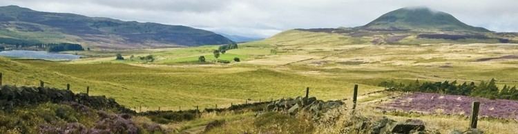
The River Eden, one of the two primary rivers in Fife, has its source on the slopes of West Lomond. On the northern slopes of the Lomond hills, two burns run down from the plateau in impressive gorges. These are the Maspie Burn and the Arraty Burn. Maspie Den has a path running along its length to an undercut waterfall at the top, which can be accessed just beyond Falkland House (approaching from the Falkland direction). Glen Vale with the Glen Burn, to the south of West Lomond, is equally impressive.
HistoryEdit
The Lomond Hills have a rich and varied history. From the Iron Age are the remains of several hill forts, which can be found around the summits of both East and West Lomond as well as at Maiden Castle, a grassy knoll that lies between the two.
In more recent history, the Lomond Hills were mined for limestone, ore and lead, although there are no longer any working quarries there today. On the southwest slopes of East Lomond are the well preserved remains of a limekiln and quarry (in which the fossilised remains of prehistoric sea creatures can be found).
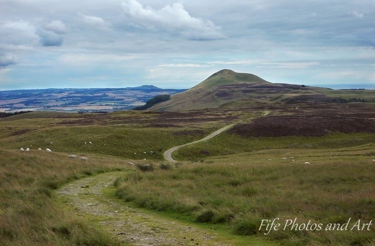
Both East and West Lomond can easily be climbed from Craigmead Car Park, which lies between the two at a height of around 300m. Alternative routes exist from the Bunnet Stane, the village of Falkland and the car park at the masts, high on East Lomond. The views from both summits, due to their prominence, are magnificent, stretching from the Highlands to the Borders, with the sea in the east.
Beneath the northern slopes of the escarpment lies Falkland Estate, an area of forest (now commercial plantation), where the kings of Scotland would have hunted whilst staying at nearby Falkland Palace. The present custodian of the palace is Ninian Crichton-Stuart, brother of the Marques of Bute.
The Lomond Hills todayEdit
Due to the steep gradients and poor soil, the primary land uses on the Lomond Hills are sheep grazing and commercial forestry (predominantly on the steep north slopes) and water catchment. There are six reservoirs in the Lomond Hills that were originally constructed to supply water to the rapidly growing mining towns of west Fife.
The Lomond Hills lie within the boundaries of Fife Regional Park, renamed the Lomond Hills Regional Park in 2003, and have their own ranger service who work principally with the landowners, estate managers and farmers on issues such as public access to help minimise the impact of recreational activities on their day-to-day business. The park covers approximately 65 square kilometres and is divided as follows: 1,120 hectares of land is in public ownership: 500 hectares belong to Fife Council and 620 are owned by Scottish Water. The balance of 5,355 hectares is privately owned.
As a result of their accessibility and proximity to several major population centres (290,000 people live within 5 miles of the park), the hills are very popular with walkers. This has resulted in a considerable amount of footpath erosion, particularly on the steeper sections, that the ranger service and volunteer workers are taking measures to counteract.
As well as walking, there are a number of more unusual recreational activities that take place in the Lomonds. East Lomond, due to the easy access from the high car park, is often used by paragliders on windy days. The Falkland Hill Race is held annually and begins at the fountain in the centre of Falkland village. The competitors must run (or in many cases walk) to the summit of East Lomond before returning to the fountain. The wooded northern slopes of East Lomond also boast a series of downhill mountainbike tracks.
Gliders from the Scottish Gliding Centre at Portmoak between Bishop Hill and Loch Leven may be seen riding the thermals above the hills.