
Elevation AMSL 2,116 ft / 645 m 6,194 1,888 Elevation 645 m | Location Lokichogio, Kenya 09/27 6,194 Code LKG Phone +254 726 830279 | |
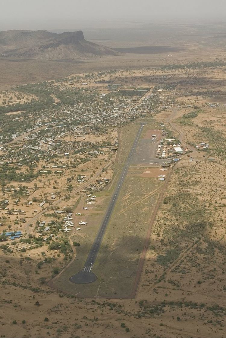 | ||
Lokichogio Airport is an airport in Lokichogio, Kenya.
Contents
Location
Lokichogio Airport (IATA: LKG, ICAO: HKLK) is located in Turkana County,in the town of Lokichogio, in the northwestern corner of the Republic of Kenya, close to the International borders with South Sudan and Uganda. Its location is approximately 678 kilometres (421 mi), by air, northwest of Jomo Kenyatta International Airport, the country’s largest civilian airport.
Overview
Lokichogio Airport is a civilian airport that serves the town of Lokichogio and surrounding communities. The airport is home to one of the world's largest and longest running humanitarian aid projects. Global aid projects are run by aid groups such as the United Nations, UNICEF, and The World Food Program to the neighbouring country of South Sudan. The airport is now home to a number of different aircraft ranging from the Lockheed Hercules to the de Havilland DHC-5 Buffalo. Many of the charities based at Lokichoggio work in collaboration with the Sudanese People's Liberation Army (SLPA), the armed forces of the Republic of South Sudan.
Situated at 645 metres (2,116 ft) above sea level, the airport has a single asphalt runway which measures 1,888 metres (6,194 ft) in length and is 19 metres (62 ft) wide.