
Population 642 (2006 census) Area 3,545 km² Postal code 4871 Number of airports 1 | Postcode(s) 4871 Mean max temp Mean min temp Elevation 17 m Local time Sunday 10:33 AM | |
 | ||
Location 2,413 km (1,499 mi) NW of Brisbane754 km (469 mi) NW of Cairns259 km (161 mi) E of Weipa LGA(s) Lockhart River Aboriginal Shire Council Weather 30°C, Wind SE at 11 km/h, 68% Humidity | ||
Lockhart River is a coastal Aboriginal community situated on the eastern coast of Cape York Peninsula in Queensland, Australia. The population consists mostly of Aboriginal and Torres Strait Islanders, whose ancestors were forcibly moved to the area beginning in 1924. At the 2006 census, Lockhart River had a population of 542, which increased to 642 at the 2011 Census.
Contents
- Map of Lockhart River QLD 4892 Australia
- History
- Population
- Climate
- History timeline
- Shopping and services
- Transport
- 2005 aircrash
- References
Map of Lockhart River QLD 4892, Australia
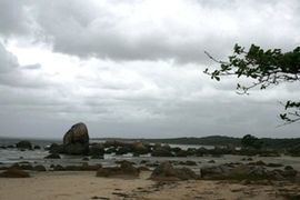
It is 800 kilometres (500 mi) north by road from Cairns and approximately 2,550 kilometres (1,580 mi) by road north of Brisbane. Lockhart River is the northernmost town on the east coast of Australia. The community is also located approximately 2 kilometres (1.2 mi) inland from Quintell Beach and is within the Iron Range National Park. During WW2, Lockhart River Airport was constructed as a bomber base, from where many sorties were flown against Japanese forces during the critical Battle of the Coral Sea, 4–8 May 1942.
Lockhart River is also the name of a river located 14 kilometres (8.7 mi) south of the community. The river was named by explorer Robert Logan Jack in January 1880 after a close friend, Hugh Lockhart.
History
Beginning in 1924, Aboriginal people gathered and were collected from eastern regions of Cape York and placed at the Anglican Church Mission at Orchid Point near the Lockhart River, which had been a centre for the sandalwood trade. Six months later, the Mission was relocated to Bare Hill, south of Cape Direction. After the Second World War broke out, the European superintendent went on furlough in 1942 and the Aboriginal people were told to go to several bush camps and fend for themselves. After 4 to 6 months, the mission was re-established but with poor resources and lack of funding. A better period followed in the 1950s under superintendent John Warby. A Cooperative Society operated during this time while in the trochus shell industry until prices failed. New housing was built and separate group villages were brought together into one on the coastal side.
Iron Range Post Office opened on 5 November 1936, closed in 1942, reopened in 1950 and was renamed Lockhart River in 1978.
In 1967, the Anglican Church handed over the mission to the Queensland Government who tried to relocate the people to Bamaga. Most of the people refused to go. In 1968-9, the people were relocated from the traditional area of the Uutaalnganu people on the coast to a new site in Kuuku Ya'u country further north and inland from Quintell Beach. This move and the assimilation policy of the new government administration resulted in much discontent and friction.
On 11 April 2014, the former locality of Lockhart was split into new localities: Iron Range and Lockhart River.
The community has DOGIT status and is governed by its own Community Council.
Population
A mix of Aboriginal and Torres Strait Islanders live in the community. The population is between 650 - 700, with most being Aboriginal and Torres Strait islanders. Approximately 30 are contract workers, including: teachers, nurses, police, shop employees, council administration, council workshop, carpenter, and plumber.
The Lockhart River 'local' population consists of five different clan groups: the Wuthathi from the north of the Olive River; the Kuuku Ya'u from Lloyd Bay and Weymouth Bay; the Uutaalnganu from the Lockhart River south to Friendly Point; the Umpila from Friendly Point to the Massey River; and the Kaanju from the inland mountain areas behind the coast. (Targeting 2000, 1995) Local language is slowing fading out.
Most of the population lives in the community town area itself. There are two 'Outstations'. The first is at 'Old Site' and is only normally used during the dry season when vehicles can drive to that location on a rough inland road. It is sometimes used as a "weekender" by some local families during the calm weather over the Christmas to January period.
The second 'Outstation' is at Chili Beach and is normally occupied all year round by the Hobson family group. It remains accessible by road and water most of the time.
A number of smaller communities also exist: these are Wattle Hills Station, Pascoe River 'Farm', Chili Beach, Packer's Bay and Portland Roads.
Wattle Hills Station is located just inside the mouth of the Pascoe River, north of Lockhart River. It is a share arrangement for persons opting out of mainstream society. Approximately 30 persons live in open-plan style houses. This station has its own airstrip and mail service once a week. Some of the houses have telephones connected and all are linked by their own private UHF radio network under the Rural Fires scheme.
Pascoe River 'farm' is located on the banks of the Pascoe River quite some distance inland. Access to the 'Farm' is from the main Lockhart River to Archer River road, 52 kilometres (32 mi) from the Lockhart River community. A track leads a further 15 kilometres (9.3 mi) to the 'Farm'. It is occupied by the Fyfe extended family group. Approximately 10 to 15 people live on the farm.
Chili Beach has a number of dwellings squatting along the secluded beaches and headlands. Approximately 10 - 20 persons live there.
Packer's Bay also has a number of open-plan and full residential style houses occupied by persons opting out of mainstream society. Approximately 10 persons live there.
Portland Roads community is a reasonably standard housing area with some open-plan style houses and no power, water or sewerage facilities. It was predominantly a fishing community until the recent changes to Fisheries Regulations. Many prawn trawlers, cray boats and yachts use this sheltered anchorage. Approximately 10 persons live here.
Climate
Lockhart River has a tropical monsoon climate (Köppen Am) closely bordering on tropical savanna climate (Köppen Aw).
History timeline
1848 The explorer Edmund Kennedy set up a base camp near the mouth of the Pascoe River. Edmund Kennedy left eight men there. By the time they were located by the supply ship, only two remained alive, the other six having died from disease and starvation.
By the 1870s Fisherman with luggers looking for trepang, pearl shell and trochus were in the coastal areas. Miners in search of tin and gold along with timber cutters were in the hills around Gordon Creek and the country inland around the Wenlock River.
1924 - 1967 The Church of England set up a mission at Ochid Point in Lloyd Bay. This mission was then moved to Bare Hill, south of Cape Direction, which is now known as 'Old Site' {Putchiwuchi in Uutaalnganu}.
1942 The 'Old Site' mission was abandoned by the non-Indigenous staff for four months after first confiscating all firearms from the local people who then returned to large campsites on their country principally along the coast for about six months. After missionary Harry Johnson returned from leave, they returned to the old mission site.
During World War II, a large American bomber base was set up at Gordon's Airstrip with three airstrips operating. The US bombers would fly to the Papua New Guinea and be met by their fighter escorts based at Bamaga and Horn Island further north. Many thousands of troops, both US and Australian, passed through as part of their jungle training, before being shipped to southeast Asia. Portland Roads community, 40 kilometres (25 mi) north of Lockhart River, was the supply port for the war effort with a large jetty. This jetty has since been removed. Many old bunkers and rusting 44 gallon drums can still be found in bush areas.
1967 - 1987 The Queensland Government took control of the mission in May 1967 and tried to move the population to Umagico, near Bamaga. Some people moved to Umagico; however, many resisted the move. The current site of the Lockhart River Community was established near Lloyd Bay in 1968-9.
1987 The Lockhart River Community was given 'Deed of Grant in Trust' (DOGIT) title of the lands. Locally elected councillors now provide administration for the Lockhart River DOGIT.
Shopping and services
School: The Lockhart State School caters to students from Early Childhood to Year 12. The school opened in January 1924. As part of support and work with the local community, the school has developed an environmental management plan, to guide staff and students in their environmental sustainability and protection projects. They are also a Reef Guardian school.
Post Office is a sub branch which offers basic postal services and on weekday afternoons basic banking services for the Commonwealth Bank. There is an EFTPOS machine next to the bank.
Council workshop also does private vehicle repairs, services and puncture repairs (no panel repairs available). A welding section is also available for very basic welding repairs and fabrications.
Health and Community: A local 'Health Clinic' is available for Primary Health Care only. It is staffed by four registered nurses with 'Remote Nursing' qualifications. The community does not have a doctor. The Royal Flying Doctor Service visits each week on Tuesday and remains overnight, flying out Wednesday afternoon. About every two months, a dentist and other medical specialists attend as needed. A basic ambulance service is available. A well set up woman's shelter exists at Lockhart River community directly opposite the police station. The shelter uses UHF CB radio channel 10. There is also a men’s centre and the Health and Community Care centre providing meals on wheels and aged care.
The retail store is a modern purposely built facilities, operated by the Department of Aboriginal and Torres Strait Islander and Multi-Cultural Affairs. This store has EFTPOS facilities, a bakery, excellent selection of fresh fruit and vegetable, dairy/deli foods, frozen foods and meats and stocks sufficient foods for day-to-day living. Opening times on week days are from 8am to 5.45pm. On Saturday the store opens at 8am to 11.45am. The store does not open on Sunday. Diesel and unleaded fuels can only be purchased by credit card or EFTPOS at the service station, no cash. It is open for self-service fuel, seven days a week from about 08.00am to about 6.00pm.
The Anglican Church shop, locally known 'Jamie's Shop’ opens most nights and on Sunday, depending on seasonal activity.
Puchiwu Fishing Cooperative sells fresh seafood, ice and has donga-style accommodation
Out of the blue at Portland Roads is a restaurant, with some take-away food available.
There is also a library, an Arts Centre (where traditional art and carvings can be purchased), a locally run radio station and free-to-air television (5 channels). There are public phone boxes, with internet and mobile phone coverage provided on the Telstra NextG network only.
Transport
Alcohol Restrictions: Lockhart River is in an alcohol restricted area. This means no alcohol or home brewing equipment is permitted in the Lockhart River shire, including roads. Heavy fines will be enforced under the Queensland Government’s alcohol management plans if you are found with alcohol in Lockhart River and many other indigenous communities in Cape York Peninsula alcohol restricted area.
Road conditions: The streets around community itself and the road to the Airport are bitumen. All other access roads are dirt. The roads are rough and hard mechanically on vehicles, as they are in the most remote community in Queensland. The access road is generally closed completely from December to March, being closed through to July in very wet years. Rivers are crocodile infested and it would be unwise to attempt to use the road during the wet season. Anybody who wants to travel off main roads and outside National Park boundaries onto traditional country must gain permission from Traditional Owners. During the dry months the road is suitable for experienced four-wheel drivers only. Some road reports give incorrect information. A current road condition can be sourced from the Lockhart River Aboriginal Shire Council.
Barge delivers to the Quintell Beach wharf weekly, freight only; no passenger service.
Airport is run by the Lockhart River Airport Corporation. It is an all-weather strip, with flights to Cairns Monday to Friday. There is self-contained accommodation available at the airport. Hire cars are available at the airport from Lockhart River Car Hire.
2005 aircrash
On 7 May 2005, a Fairchild Aircraft Inc. SA227-DC Metro 23 aircraft, registered VH-TFU, with two pilots and 13 passengers, was being operated by Transair on an instrument flight rules regular public transport service from Bamaga to Cairns, with an intermediate stop at Lockhart River, Queensland. At 1143:39 Eastern Standard Time, the aircraft impacted terrain in the Iron Range National Park on the north-western slope of South Pap, a heavily timbered ridge, approximately 11 kilometres (6.8 mi) north-west of the Lockhart River aerodrome. At the time of the accident, the crew was conducting an area navigation global navigation satellite system (RNAV (GNSS)) nonprecision approach to runway 12. The aircraft was destroyed by the impact forces and an intense, fuel-fed, post-impact fire. There were no survivors.