
Surface elevation 351 m | Basin countries United Kingdom Volume 1.08 km³ | |
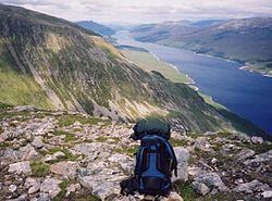 | ||
Loch Ericht (Scottish Gaelic, Loch Eireachd) is a freshwater loch on the border between Perth and Kinross and the Highlands Council areas of Scotland. It is situated at a height of 351 metres above sea level and has a north-east to south-west orientation. The village of Dalwhinnie lies at the north east end of the loch. The loch is 14.5 miles (23.3 km) in length and has a surface area of approximately 7 square miles. Loch Ericht is the tenth largest freshwater lake in Scotland and has a good reputation for its trout fishing.
Contents
Map of Loch Ericht, United Kingdom
The loch is part of a hydro-electric scheme and is dammed at both ends. Water flows into the northern end via the Cuaich Aqueduct. The southern end is linked to a hydro-electric power station at Loch Rannoch by the 4-mile (6.4 km) long River Ericht. The northern dam protects the village of Dalwhinnie from flooding.
Loch Ericht is surrounded by a number of Munros, including Ben Alder (1148 metres) and Geal-Chàrn (1132 metres). Traditional hunting areas border the loch. These are called forests; the chief of which is Ben Alder Forest.
Mapping
Loch Ericht is covered by
Ordnance Survey Explorer map 393 (1:25000) Ben Alder, Loch Ericht and Loch Laggan (ISBN 9780319239186) and
Ordnance Survey Landranger map 42 (1:50000) Glen Garry and Loch Rannoch (ISBN 9780319231296).