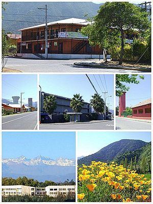
Country Chile Time zone CLT (UTC-4) Local time Thursday 10:46 AM | Region O'Higgins Demonym(s) Mirandino Elevation 407 m | |
 | ||
Weather 19°C, Wind S at 5 km/h, 71% Humidity | ||
Lo miranda 1987
Lo Miranda is a Chilean city, located in the commune of Doñihue, O'Higgins Region.
Contents
- Lo miranda 1987
- Map of Lo Miranda DoC3B1ihue OHiggins Region Chile
- Lo miranda desfile fiestas patrias 2016
- History
- Demographics
- Economy
- Architecture
- Sports
- References
Map of Lo Miranda, Do%C3%B1ihue, O'Higgins Region, Chile
Lo miranda desfile fiestas patrias 2016
History
Lo Miranda is named after Pedro de Miranda y Rueda, who was given from the Governor of Chile Rodrigo de Quiroga an encomienda (the Encomienda de Copequén) which comprises the territory in which Lo Miranda was established in 1577. His son, Pedro de Miranda y Rueda, inherited the land and founded Lo Miranda on October 15, 1577.
Lo Miranda was named a "villa" in 1897.
Demographics
The town of Lo Miranda has, as of 2002, 8,188 inhabitants, of which 4,090 are men, and 4,098 are women. There are 2,233 households which occupy 9.17 square kilometers.
Economy
Lo Miranda is located in a mainly agricultural area, it is also known for its poultry industry, as the slaughtering plant of Agrosuper is located there. Additionally, the Mirandinos sell chamantos and Chacolí candies.
Architecture
Most of the houses were constructed with adobe and mud, with clay tiles. The main square, several stores and the local church are located in the historical centre of the town. The local church was created on August 15, 1936 by the Bishop of Rancagua, Monsignor Rafael Lira Infante.
Sports
There was a sports club founded by Agrosuper (then Super Pollo), called Súper Lo Miranda, founded on August 10, 1980.
