
Sovereign state United Kingdom Local time Thursday 1:32 PM | Country Wales Postcode district CF | |
 | ||
Weather 11°C, Wind NE at 34 km/h, 66% Humidity | ||
Llysworney (Welsh: Llyswyrni) is a small village in the Vale of Glamorgan, South Wales.
Contents
Map of Llysworney, Cowbridge, UK
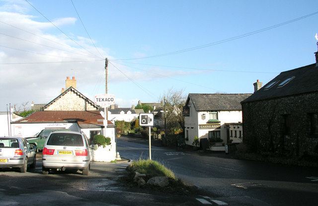
Llysworney is home to about 240 people and has around 100 houses. It is situated about 2 miles away from Cowbridge in the Vale of Glamorgan. The B4268, a major lorry route, connecting the A48 with Llandow and Llantwit Major, runs through Llysworney. The Village is home to the locally well-known Carne Arms Pub, St. Tydfils Church, a duck pond, and Llysworney Garage.
The Carne Arms
Dating back over 400 years the Carne Arms is an old inn with open fires. Thought to have originally been part of the local Rectory its name is ancient and is derived from the Cornish "Carn" which means "rock". However, in this instance, the inn probably received its name in memory of a wealthy and influential local family rather than from the feature of the local landscape.
St. Tydfils Church
Friendly, all-age congregation worshipping in an ancient church with a most unusual groundplan. Regular Sunday worship.
(Text from Diocese of Llandaff Page)
Worney Wood
The wood was founded in the millennium year of 2000. The wood is kept by the Woodland Trust and is sponsored by Homebase. The wood was planted by locals and is open Free 24 hours, 7 days a week. Worney Wood allows dogs. Worney wood hosts a range of trees and hedgerows. For more information visit the Woodland Trust page