
Population 3,906 (2011) Sovereign state United Kingdom Local time Thursday 11:51 AM | OS grid reference SO312164 Country Wales Postcode district NP7 Dialling code 01600 | |
 | ||
Weather 8°C, Wind NE at 24 km/h, 86% Humidity | ||
Llantilio Pertholey (Welsh: Llandeilo Bertholau) is a community (parish) and small village in Monmouthshire, south east Wales. It is located 1.5 miles (2.4 km) to the north-east of the market town of Abergavenny, just off the A465 road to Hereford. The parish covers a large area beneath the Skirrid, an outlier of the Black Mountains; much of the parish lies within the easternmost part of the Brecon Beacons National Park.
Contents
Map of Llantilio Pertholey, UK
Governance
The village falls in the 'Mardy' electoral ward. This ward stretches to the east. The total population taken at the 2011 census was 1,469.
History and amenities
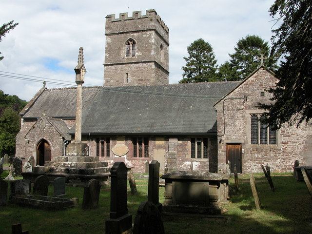
The 13th century medieval Church of St Teilo is named after a 6th-century Bishop of Llandaff who was canonised for his good works. The church is a fine example of a rural Welsh church with three chantry chapels dating from about 1350.
The hamlet also had a primary school, which moved to the nearby Mardy district of Abergavenny in 1991. A popular pub, The Mitre, opposite the church closed some years ago.