
OS grid reference SO362201 Country Wales Postcode district NP7 Local time Thursday 11:22 AM | Sovereign state United Kingdom Dialling code 01873 | |
 | ||
Weather 7°C, Wind NE at 23 km/h, 87% Humidity | ||
Llangattock Lingoed (Welsh: Llangatwg Lingoed) is a small rural village in Monmouthshire, south east Wales. It is located approximately five miles north of Abergavenny, between Abergavenny and Grosmont, a few miles south of the Wales-England border. Offa's Dyke Path passes through the village. The village is near the Black Mountains and the Brecon Beacons National Park.
Contents
Map of Llangattock Lingoed, Abergavenny, UK
Amenities and history
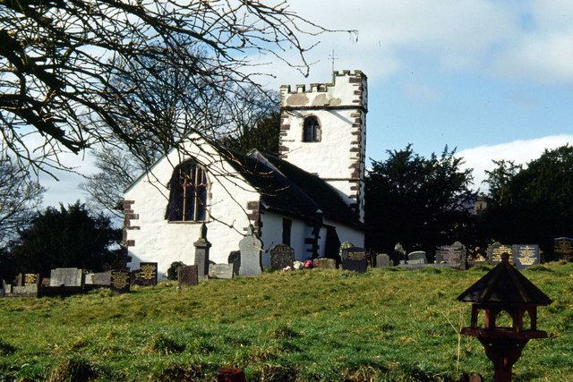
The parish church is St Cadoc's and both the village and the church have a long and interesting history sandwiched as they are in the Welsh Marches between border castles and the historical personalities holding sway at any given time.
The Old Court is a Grade II* listed building situated in the village.
The Cistercian Way long distance footpath that circumnavigates all of Wales also passes through the village.