
Population 1,293 Sovereign state United Kingdom Local time Thursday 11:15 AM | OS grid reference SH369912 Country Wales Postcode district LL68 | |
 | ||
Weather 8°C, Wind NE at 26 km/h, 83% Humidity | ||
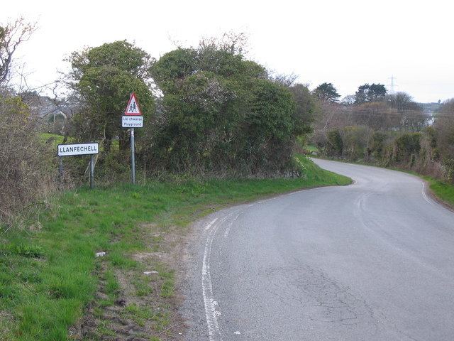
Llanfechell (Welsh: Llanfechell llan church + Saint Mechell) is a village in Anglesey, North Wales, UK. It is the largest of several small villages and dispersed settlements that make up Mechell Community Council area. It is 11 miles (18 km) east of Holyhead, and 5.6 miles (9.0 km) west of Amlwch, on the north of the island.
Contents
- Map of Llanfechell Amlwch UK
- History
- Community activities
- Church and chapel
- Buildings
- Ancient sites
- Baron Hill Maen Hir
- Llanfechell Triangle
- Pen y Morwydd Barrow
- Llifad enclosure
- Other archaeological sites
- References
Map of Llanfechell, Amlwch, UK
Mechell Community (which also includes Mynydd Mechell and Carreglefn) has a 2001 population of 1,532., decreasing to 1,293 in 2011. Village services include a church, a primary school, a pub and two chapels. It is an agricultural area, and has been a local centre for markets, livestock fairs, and had both a watermill and windmill. The area round about has many prehistoric monuments.
History
The many prehistoric remains close to the village indicate the area has been lived in for thousands of years. The first written mention of Llanfechell itself is in 1291. However, the name Lanfechell means Church of St Mechell (The 'M' becomes 'F', pronounced v.). Mechell appears to have been a 6th-century missionary, possibly from Brittany, who founded a monastery here. A 17th century manuscript, (Llanstephan MS. 125) records a Welsh poem, "Cywydd i Fechell Sant". This describes how St Mechell was offered a gift of land in gratitude for a miraculous healing, to be demarked by the route of a released hare. The hare, under divine guidance, marked the full extent of what is now the parish of Llanfechell, on which he then founded the monastery.
18th century life in Llanfechell was described in great detail by William Bulkeley (4 November 1691 - October 1760). From 30 March 1734 to September 1760 he kept a daily diary recording Anglesey life, social customs, personal and family dealings, farming practices and the weather. William Bulkeley lived at Brynddu as Squire of Llanfechell. His daughter married Fortunatus Wright, a brewer from Liverpool whose colourful life included periods as a privateer.
Llanfechell was one of a network of market towns on Anglesey. During the 18th century and following, in addition to its weekly market day the village held a fair several times a year, for the sale of livestock and produce. The Llanfechell Fair (Welsh: Ffair Mechell) no longer includes livestock and agricultural sales, but continues as a horticultural show and family fun day at Llanfechell Community School in late July.
A war memorial in the village square records those from the village who died in both world wars, three sons of Brigadier-General Owen Thomas of Brynddu, who headed Lloyd George's Welsh Army.
Community activities
'Menter Mechell' is an umbrella community venture, which helps facilitate a variety of activities and interest groups in the village. Areas of activity include the History Group, a Hobbies Group, the Maes Martin playground and sports project and an Allotment Group.
Church and chapel
St Mechell's Church includes features that date back to the 12th century. It is a grade II* listed building in the centre of the village (location:53.3930°N 4.4536°W / 53.3930; -4.4536 (St Mechell Church), SH369913 ). St Mechell's Day is 15 November. The thick stone walls are whitewashed externally, while the stone tower has a single bell, and is topped by an unusual cupola. The church is part of the Anglican Church in Wales, in the diocese of Bangor, and holds bilingual services at 10.00am each Sunday.
Facing the church across the village square is Libanus Chapel (Welsh: Methodistiaid Calfinaidd, Welsh Calvanistic Methodist). Founded in 1832, it was rebuilt in 1903. Ebenezer Chapel, a Welsh Independent chapel, is near the school on Mountain Road. Built in 1862, it replaced a chapel built soon after 1800. Both chapels are listed grade II.
Buildings
In addition to the three churches, there are six other listed buildings within the village (all grade II):
Ancient sites
There are four scheduled monuments close to the village:
Baron Hill Maen Hir
The standing stone 440 yards north of Llanfechell Church, known as Baron Hill Maen Hir, is a prehistoric standing stone (one of many such on Anglesey). The stone is 6.6 feet (2.0 m) high, with a further 19 in (0.5m) below ground and weighs 4.6 tons. In 2009 it had keeled over, and in 2010 it was lifted and re-set in position by Gwynedd Archaeological Trust under the guidance of Cadw. When removed from its socket, some 20 packing stones were found around its base, one of which had two 'pecked' engravings, a cupmark and a cup and ring mark. The engraved stone is now at Oriel Ynys Môn Museum, Llangefni. Such rock engravings are very rare in North Wales, and its use as part of the construction of the standing stone implies a particular, if unknown, significance. It is Located at 53.3964°N 4.4531°W / 53.3964; -4.4531 (Standing Stone east of Llanfechell), grid reference SH369916.
Llanfechell Triangle
The Llanfechell Triangle Standing Stones are a group of three prehistoric standing stones at 53.3966°N 4.46204°W / 53.3966; -4.46204 (Llanfechell Triangle Standing Stones), grid reference SH363916. They are all around 6.6 feet (2.0 m) high with their long axis aligned NW-SE. They are thought to date to the Bronze Age.
Pen-y-Morwydd Barrow
Pen-y-Morwydd Barrow, is a burial mound, probably from the Bronze Age, on the top of a hill between Llanfechell and Bodewryd. It is 27 yards (25 m) across, and 6.6 feet (2.0 m) high, crossed by a modern wall. A footpath from Rhosbeirio crosses the mound. (Location: 53.3933°N 4.4306°W / 53.3933; -4.4306 (Pen-y-Morwydd Barrow), grid reference SH385913)
Llifad enclosure
Llifad enclosure is a later prehistoric pentagonal enclosure, 49 yards (45 m) across. It is a possible defended settlement a few hundred metres south of Pen-y-Morwydd Barrow, on the same hill, towards Carreglefn. Location: 53.3915°N 4.4302°W / 53.3915; -4.4302 (Llifad enclosure), grid reference SH384910
Other archaeological sites
In addition to the scheduled sites, a range of other archaeological and historic sites are known: