Mechell's settlements are all on inland situations, although a narrow strip of land reaches up as far as the north coast of the island, east of Cemaes Bay, in Llanbadrig Community. To the east is Cylch-y-Garn Community, and to the south is Tref Alaw and Rhosybol.
There are three wards within the Mechell community area, with a total of 10 councillors representing Llanfechell, Mynydd Mechell and Carreglefn, plus a chairperson.
The oldest of the settlements appears to be Llanfechell, named, as is the larger community, after the 6th century saint Mechell, reputedly a Breton missionary. Tradition has it that he is buried in Llanfechell. The large number of prehistoric sites attest to human habitation across the Community since well before that.
There is a very detailed account of daily life in the Mechell area during the 18th century, within the diaries of William Bulkeley, (1691-1760). He lived at Brynddu, a house on the edge of Llanfechell, and kept a daily record of Anglesey life from 1734 to 1760.
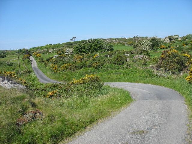
The land of Mechell Community is a settled agricultural landscape, with a network of small farms. The longstanding importance of arable agriculture is shown by the remains of two watermills and four windmills in the Mechell area: Meddanen Water Mill and Melin Mechell Windmill (also known as Minffordd Mill and Melin Maen Arthur), SH362902 are close together so could have been worked by the same miller, utilising water and wind as available.
Cafnan Water Mill is the other watermill. Pant y Gŵydd Mill; Cefn Coch Mill and Pandy Cefn Coch Mill are the other windmills.
Wylfa Nuclear Power Station, close to the Community boundary's northern tip, was the only substantial employer in the immediate neighbourhood, on the coast, 3 kilometres (1.9 mi) northwest of Llanfechell. It was the only Nuclear Power Station in Wales after Trawsfynedd shut down. The site produced electricity from 1971, and ceased at the end of 2015. Proposals from Horizon Nuclear Power to build 'Wylfa Newydd' are under consideration.
Mechell Community has 4 Church in Wales buildings in the Bangor Diocese and Bro Padrig Deanery,
St Mechell's Church, Llanfechell(Grade II* listed). 12th century church with 19th century rebuild. SH369913
53.3930°N 4.4536°W / 53.3930; -4.4536 (St Mechell Church).
St Fflewin's Church, Llanfflewin(Grade II listed) in Mynydd Mechell. Documentary records from 1254, but the oldest extant fabric appears to be 18th century, extensively restored in the 1930s. SH350890
53.3724°N 4.4822°W / 53.3724; -4.4822 (St Fflewin's Church).
St Mary's Church, Bodewryd(Grade II listed). The present structure is from the 16th century or earlier, and on a much earlier site. The original dedication was to St Gewryd. SH400906,
53.3878°N 4.4071°W / 53.3878; -4.4071 (St Mary's Church, Bodewryd).
St Peirio's Church, RhosbeirioGrade II listed, now disused. SH391917.
53.3980°N 4.4213°W / 53.3980; -4.4213 (St Peirio's Church, Rhosbeirio).
Capel Anhunedd-y-PranThere is a redundant (or decayed) medieval chapel at Clegyrog. By 1796 it was in use as a cowhouse. SH388903, Coordinates:
53.3849°N 4.4252°W / 53.3849; -4.4252 (Capel Anhunedd-Y-Pran, Clegyrog).
Cappel NewsaintAn unlocated medieval chapel stood somewhere in Mynydd Mechell. SH3590.
53.381°N 4.4821°W / 53.381; -4.4821 (Cappel Newsaint).
There have been least nine non=conformist Chapels in the Mechell area, dating to the nineteenth and early 20th centuries:-
Libanus Chapel, LlanfechellMethodistiaid Calfinaidd, Welsh Calvanistic Methodist Chapel on the village square. Founded in 1832, rebuilt in 1903. SH369912.
53.3927°N 4.4542°W / 53.3927; -4.4542 (Libanus Chapel, Llanfechell)Ebenezer Chapel, LlanfechellWelsh Independent chapel near the School, on Mountain Road. Built 1862, replacing a Chapel built soon after 1800. SH365909,
53.3896°N 4.4598°W / 53.3896; -4.4598 (Ebenezer Chapel, Llanfechell)Calfaria Chapel, Mynydd MechellWelsh Baptist chapel built in 1897 to replace an earlier building of 1815. SH361900
53.38113°N 4.4663°W / 53.38113; -4.4663 (Calfaria Chapel, Mynydd Mechell)Jerusalem Chapel, Mynydd MechellMethodistiaid Calfinaidd, Welsh Calvanistic Methodist chapek. SH358897,
53.3783°N 4.4709°W / 53.3783; -4.4709 (Jerusalem Chapel, Mynydd Mechell)Bethlehem Chapel, CarreglefnWelsh Calvinistic Methodist chapel. SH383891,
53.3744°N 4.4318°W / 53.3744; -4.4318 (Bethlehem Chapel, Carreglefn)Seion Chapel, CarreglefnIndependent Chapel. SH394895,
53.3778°N 4.4164°W / 53.3778; -4.4164 (Seion Chapel, Carreglefn)Hephsibah Chapel, RhosbeirioFormer Welsh Calvinistic Methodist Chapel, converted into a house in 1985. SH394913,
53.3943°N 4.4164°W / 53.3943; -4.4164 (Hephsibah Chapel)Capel Bethania, TregeleThe Calvinistic Methodist cause at Tregele began in 1810. The Chapel was rebuilt in 1906 and closed in 1973 and is now a house.
All four extant medieval churches above are given the legal protection of Listed Building status. Below are the other listed buildings within the community, plus some other notable buildings and structures:-
Plas Bodewryd(Grade II* listed mansion). A 15th/16th century Hall house at Bodewryd, with substantial additions in every century following. SH40019082,
53.3899°N 4.4073°W / 53.3899; -4.4073 (Plas Bodewryd mansion).
Bodewryd Colomendy or Dovecote, BodewrydGrade II listed late 17th C. dovecote in the grounds of Plas Bodewryd. Stone walls incorporate around 400 nests. SH40019082,
53.3899°N 4.4073°W / 53.3899; -4.4073 (Bodewryd Colomendy or Dovecote).
Lychgate at Church of St Mary, BodewrydGrade II listed building. SH40119057,
53.3877°N 4.4057°W / 53.3877; -4.4057 (Lychgate at Church of St Mary).
Brynddu, LlanfechellGrade II listed 18th Century larger Anglesey house. Home of the Bulkeley Family. SH37329119
53.3924°N 4.4479°W / 53.3924; -4.4479 (Brynddu).
Pont-y-Plas, LlanfechellRoad Bridge with square headed arches and steps to water. SH36889135||
53.3937°N 4.4546°W / 53.3937; -4.4546 (Pont-y-Plas).
Crown Terrace, including Crown House, LlanfechellGrade II listed row of three terraced buildings with a shop/bank. SH369912,
53.3924°N 4.4542°W / 53.3924; -4.4542 (Crown Terrace, Inc.Crown House).
Old Rectory, LlanfechellGrade II listed, 17th Century Rectory, with 18th C additions. SH36989128,
53.3931°N 4.4531°W / 53.3931; -4.4531 (Old Rectory)War Memorial, LlanfechellGrade II listed memorial to the fallen of the Great War, in the village square and incorporates a clock. SH37029120||
53.3924°N 4.4525°W / 53.3924; -4.4525 (War Memorial)Ffynnon Ddygfael, Mynydd MechellWell shaft close to a pool. SH35119050||
53.3855°N 4.4808°W / 53.3855; -4.4808 (Ffynnon Ddygfael).
Llanddygfael-groes, Mynydd MechellGrade II listed building. SH35149059||
53.3863°N 4.4804°W / 53.3863; -4.4804 (Llanddygfael-groes).
Cae Mawr, TregeleGrade II listed late 18th century farmhouse. SH34929088||
53.3889°N 4.4838°W / 53.3889; -4.4838 (Cae Mawr, Tregele).
Cefn-Coch, TregeleGrade II listed ||17th century central hall type house, with pointed internal doorways and 17th C. balusters. SH34259072
53.3872°N 4.4938°W / 53.3872; -4.4938 (Cefn-Coch).
Groesfechan, TregeleMedieval domestic remains. SH351917||
53.3963°N 4.4815°W / 53.3963; -4.4815 (Groesfechan)Melin Cefn Coch (Ty'n y Felin), TregeleGrade II listed building. SH34319139,
53.3933°N 4.4932°W / 53.3933; -4.4932 (Melin Cefn Coch).
Cottage at Pant-y-Gist, CarreglefnGrade II Listed Building, SH39358967,
53.3794°N 4.4167°W / 53.3794; -4.4167 (Cottage at Pant-y-Gist).
Hen Bont, CarreglefnGrade II listed building. SH38408907||
53.3737°N 4.4306°W / 53.3737; -4.4306 (Hen Bont).
Pant-y-cryntach, CarreglefnGrade II listed building. SH38808967,
53.3792°N 4.4249°W / 53.3792; -4.4249 (Pant-y-cryntach)Ty Newydd, CarreglefnGrade II listed building. SH38408907,
53.3737°N 4.4306°W / 53.3737; -4.4306 (Ty Newydd).
Y Stryd, CarreglefnGrade II listed building. SH38398906,
53.3736°N 4.4307°W / 53.3736; -4.4307 (Y Stryd)Twll-y-clawdd, LlanfflewynGrade II listed building. SH35638861,
53.3687°N 4.4719°W / 53.3687; -4.4719 (Twll-y-clawdd).
There are five Scheduled monuments within the community area, all of them dating to prehistory, and a further 10 sites are also listed by the Royal Commission on the Ancient and Historical Monuments of Wales. All the sites are in open country within the community aea, so cannot be said to be in any one of the settlements. The 'settlement' column is there to give a guide as to which part of Mechell Community it is in.
Other Archaeological sites in Mechell:-