Kalpana Kalpana (Editor)

Lizonne

Updated on
Edit
Like
Comment
Share on FacebookTweet on TwitterShare on LinkedInShare on Reddit
River mouth
  
Dronne 48 m (157 ft)

Length
  
60 km

Mouth
  
Dronne

Basin size
  
640 km (250 sq mi)

Basin area
  
640 km²

Country
  
France

Lizonne httpsuploadwikimediaorgwikipediacommonsthu

Main source
  
Sceau-Saint-Angel 200 m (660 ft)

Progression
  
Dronne→ Isle→ Dordogne→ Atlantic Ocean

Discharge
  
Average rate: 5.28 m/s (186 cu ft/s)

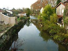
The Lizonne (French: la Lizonne), also called the Nizonne, is a 60.5 km (37.6 mi) long river in the Dordogne and Charente departments in southwestern France. Its source is near Morelière, a hamlet in Sceau-Saint-Angel. It flows generally southwest. It is a right tributary of the Dronne, into which it flows between Saint-Séverin and Allemans.

Contents

Map of La Lizonne, France

Part of its course forms part of the border between the Dordogne and Charente departments.

Departments and communes along its course

This list is ordered from source to mouth:

  • Dordogne: Sceau-Saint-Angel, Saint-Front-sur-Nizonne, Champeaux-et-la-Chapelle-Pommier, Rudeau-Ladosse, Saint-Sulpice-de-Mareuil, Puyrenier, Beaussac, Les Graulges, Sainte-Croix-de-Mareuil, Combiers, La Rochebeaucourt-et-Argentine,
  • Charente: Édon,
  • Dordogne: Champagne-et-Fontaine,
  • Charente: Blanzaguet-Saint-Cybard, Gurat,
  • Dordogne: Vendoire,
  • Charente: Vaux-Lavalette, Salles-Lavalette,
  • Dordogne: Nanteuil-Auriac-de-Bourzac,
  • Charente: Palluaud,
  • Dordogne: Bouteilles-Saint-Sébastien, Saint-Paul-Lizonne,
  • Charente: Saint-Séverin,
  • Dordogne: Allemans,
  • References

    Lizonne Wikipedia