
Discharge 25.1 m³/s | Length 201 km | |
 | ||
Main source Massif Central510 m (1,670 ft) Progression | ||
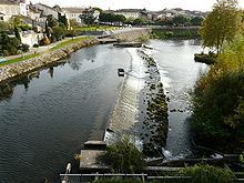
The Dronne is a 201-kilometre (125 mi) long river in southwestern France, right tributary of the Isle. Its source is in the north-western Massif Central, east of the town of Châlus (south-west of Limoges) at an elevation of 510 metres (1,670 ft). It flows south-west through the following départements and towns:
Map of La Dronne, France
The Dronne flows into the Isle in Coutras.
References
Dronne Wikipedia(Text) CC BY-SA