
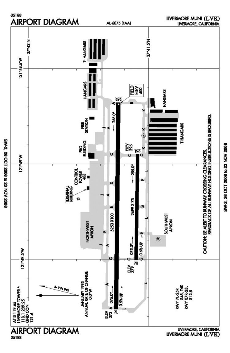
Airport type Public 7L/25R 5,253 Code LVK Phone +1 925-960-8220 | Operator City of Livermore Elevation AMSL 400 ft / 122 m 5,253 1,601 Elevation 122 m Number of runways 2 | |
 | ||
Address 680 Terminal Cir, Liver, CA 94551, USA Similar Attitude Aviation, City of Dublin Fire Preventio, Liver ‑ Pleasanton Fire Depa, Mineta San José Internatio, Red Sky Aviation LLC Profiles | ||
Approach to lvk livermore municipal airport
Livermore Municipal Airport (IATA: LVK, ICAO: KLVK) is in Livermore, California, United States, east of San Francisco Bay. It is classified by the FAA as a Regional Relief Airport.
Contents
The airport is 3 miles (4.8 kilometres) northwest of the downtown area. Near the 650-acre (260-hectare) airport are the Water Reclamation Plant and the Las Positas Golf Course. There are two parallel asphalt runways. The main lighted runway is 5,250 ft (1,600 m) long. The second runway, unlighted, built in 1985, is 2,700 ft (820 m) long and is used mainly for training. Besides the 2,400-square-foot (220 m2) terminal building, built in 1969, there are nearly 400 aircraft storage hangar units, a corporate-style hangar building containing 20,000 square feet (1,900 m2) of space and an aircraft storage shelter. 467 aircraft are based at Livermore Airport.