
Sovereign state United Kingdom Postcode district CB10 Dialling code 01799 | ||
 | ||
Communicating with wwii spirit raf little walden s02e09
Little Walden is a small settlement in the Uttlesford district, in the English county of Essex. It lies about 3 miles (5 km) north of the market town of Saffron Walden and is 12 miles (19 km) from Cambridge.
Contents
- Communicating with wwii spirit raf little walden s02e09
- Map of Little Walden Saffron Walden UK
- History
- Transport
- References
Map of Little Walden, Saffron Walden, UK
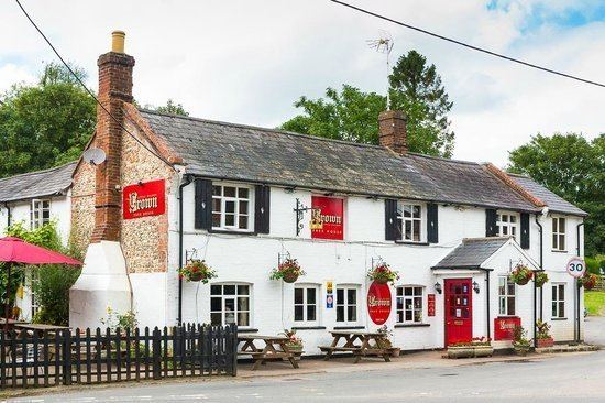
The church, St.John's is a "remnant of Victorian concern for the spiritual welfare of the very poor labourers who lived here then". The Crown Inn public house is situated on a bend in the B1052 road which runs through the village. Chesterford Research Park is 0.84 miles (1.35 km) to the north west.
History
In Little Walden parish are the remains of a banked enclosure which may date from the Iron Age.
A World War II airfield to the north, RAF Little Walden, closed in 1958.
Transport
A bus service between Linton and Saffron Walden calls at Little Walden (Tuesdays only).
The nearest railway station is Great Chesterford.