
Sovereign state United Kingdom Region East of England Admin HQ Saffron Walden | Constituent country England Non-metropolitan county Essex Area 641.2 km² | |
 | ||
Status Non-metropolitan district Points of interest Audley End House, Stansted Mountfitchet Castle, Fry Art Gallery, Bridge End Gardens, Saffron Walden Museum Destinations Stansted Mountfitchet, Saffron Walden, Great Dunmow, Thaxted, Clavering | ||
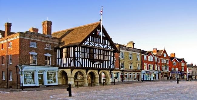
Uttlesford is a local government district in Essex, England led by its council in a central town in the district, Saffron Walden, which is 38 miles (61 km) NNE of London. the population of the District at the 2011 Census was 79,443.
Contents
- Map of Uttlesford District UK
- History
- Economy
- Housing
- Elections
- Energy policy
- In the media
- Uniqueness
- References
Map of Uttlesford District, UK
History
Its name is derived from the ancient Hundred of the same name, possibly from Udel's ford.
The district was formed on 1 April 1974 by the merger of the borough of Saffron Walden, Dunmow Rural District and Saffron Walden Rural District.
Economy
Apart from considerable agriculture, retail and office premises in towns, Uttlesford District includes London Stansted Airport, which is its largest employer. For more detailed analysis of strengths and specializations in the economy see individual settlements, for instance the article: Saffron Walden. In October 2008, the airport won a 40% increase in permitted flights under the flight cap which operates in relation to the airport, from the UK government.
Aside from countryside hotels close to and aircraft maintenance vital to Stansted Airport, airlines have also used a small adjoining business park. Titan Airways has its head office in the Enterprise House in the grounds in Stansted Mountfitchet.
Several airlines, including Buzz, AirUK (later KLM uk), AB Airlines, Go Fly had its head office at the Enterprise House. and Lloyd International Airways had their head offices on the property of Stansted Airport.
Housing
The district has the highest average house price of the 14 districts in the ceremonial county of Essex and of the 12 districts administered by Essex County Council. To Autumn 2012, Uttlesford had the 2nd highest quarterly increase in house prices after the Borough of Basildon and 2nd highest annually after the Borough of Chelmsford, both exceeding 5%. As a whole the county has a wide range in house prices, with Uttlesford's average house price only 0.85% greater than in Epping Forest District and 203% greater than the lowest-ranked Tendring district of Essex.
House prices were among the top 10 local authorities for resilience in having returned to or exceeded 2007 levels in a 2011 statistical analysis by The Times.
Elections
The Conservatives held 31 seats in the 2011-2015 term. They retained control of the Council in the 2015 elections, but with a significantly reduced number of seats (-26%). They lost seats to new local party Residents for Uttlesford, who now comprise the second largest party in the District.
Energy policy
In May 2006, a report commissioned by British Gas showed that housing in Uttlesford produced the highest average carbon emissions in the country at 8,092 kg of carbon dioxide per dwelling. In response the council stated
We try and lead by example but there is nothing else we can do to get people to save energy
Uttlesford council has, however, introduced a planning permission condition requiring certain energy conservation measures to be taken when homes are extended, and has a number of other initiatives.
A 2010 study by the consultancy Altechnica indicated that all of Uttlesford's energy could come from renewable sources.
In the media
In 2001, Uttlesford was voted as the best place to live in England, in a survey by the Sunday Times. A range of factors, including housing costs, quality of schools and low crime contributed to the overall result. Uttlesford has also been polled as the healthiest place to live in the UK.
Uniqueness
The district is the only British local authority at non-parishes-level to begin with the letter 'u'. The only other letter of the alphabet used by only one UK local authority is 'y' is often seen in tables as York, but more properly on letters and in publications is seen as City of York.