
- elevation 6,739 ft (2,054 m) - elevation 4,363 ft (1,330 m) | ||
 | ||
- location east of the Santa Rosa Range, Humboldt County, Nevada | ||
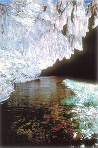
The Little Owyhee River is a 61-mile (98 km) long tributary of the South Fork Owyhee River. Beginning at an elevation of 6,739 feet (2,054 m) east of the Santa Rosa Range in eastern Humboldt County, Nevada, it flows generally east into Elko County, Nevada and the Owyhee Desert. From there, it flows north into Owyhee County, Idaho and reaches its mouth at an elevation of 4,363 feet (1,330 m).
Map of Little Owyhee River, Idaho, USA
References
Little Owyhee River Wikipedia(Text) CC BY-SA