
Highest point Litløytinden Elevation 103 m | Highest elevation 103 m (338 ft) County Nordland Area 67 ha Municipality Bø, Nordland | |
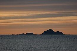 | ||
Litløya (meaning "Little Island") is a small island in the municipality of Bø in Nordland county, Norway. It is part of the Vesterålen archipelago, about 6 kilometres (3.7 mi) southwest of the village of Bø on the coast of Langøya island. The 0.67-square-kilometre (0.26 sq mi) island is best known for the Litløy Lighthouse located on the western part of the island. Its highest point is the 103-metre (338 ft) tall «Litløytinden».
Contents
Map of Litl%C3%B8ya, 8470 B%C3%B8 i Vester%C3%A5len, Norway
History
From the Middle Ages until the 20th century the island, together with its neighbour Gaukværøya, was a busy seaport and centre for local fishermen.
There were 71 inhabitants registered on Litløya in 1865. Fishing was their main commerce and when the cod arrived in springtime many regional neighbours came flocking to take part. In 1895, there were 875 fishermen registered at Litløya and Gaukværøya, in 1890 there were 880 registered. These numbers probably includes fishermen from other municipalities.
Once inhabitants on the "mainland" (the large Langøya island) got electricity, water, and phone connections and boats became motorised, many inhabitants left the islands for a more comfortable life. Those who stayed on the island were offered government support to move to the "mainland" in the 1950s. Since then, the island has been virtually uninhabited and some remains of the houses still exist. Currently, the island's only permanent inhabitant is the owner of Litløy Lighthouse, though various support staff are often present to help with renovations and daily tasks. The lighthouse currently offers overnight accommodation for visitors as well.
Attractions
There is also a cave at Litløya, called «Trollhola». This means "Cave of the troll". The cave is 40 metres (130 ft) deep and can be explored with a flashlight or headlamp. Access to the cave is slightly cumbersome. The cave was formed whilst this part of the island was under water, possibly 100,000 years ago, according to NGU, Norsk Geologisk Undersøkelse.
The county archaeologist visited Litløya and Gaukværøya in the spring of 2010. Several sites from the stone age, iron age and Middle Ages were identified, including two farms and a grave that possibly contains a boat. A coastal path is currently being established in order to share the current knowledge of the island with visitors.