
Time zone WET (UTC+0) Website lisaculinfo.ie Population 764 (2006) | Irish Grid Reference M911163 Elevation 80 m | |
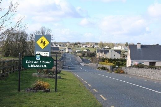 | ||
Lisacul (Irish: Lios an Choill, meaning The Fort of the Hazel Tree) is a village in the north west of County Roscommon, Ireland, situated on the R293 midway between Ballyhaunis in County Mayo and Ballaghaderreen, County Roscommon. It is part of the Barony of Frenchpark (the de Freyne family).
Contents
- Map of Lisacul Co Roscommon Ireland
- Schools
- Landscape
- The Community Centre Memorial Hall
- Handball Alley
- 365 Project
- References
Map of Lisacul, Co. Roscommon, Ireland
Schools
There are two schools in Lisacul. Brightsparks Montessori and Lisacul National School. Brightsparks has a roll of 22 pupils, while the national school has 72 pupils and seven staff, including the head teacher and administrative staff.
Landscape
The entrance to the Pollawoddy Cave system, the longest cave system in Roscommon, is in Carrownaknockaun. The system of chambers and passages, which was formed by the action of underground streams on the limestone foundation, was surveyed by the Geological Survey of Ireland in 2000. The limestone pavement results in an abundance of sinkholes and the sudden appearance of streams around Lisacul. Many of the latter feed into the River Lung, the principal river in Lisacul, which takes its name from the Luighne people, who claimed ancestry from Lugh, the Celtic war deity
The principal river in Lisacul, the Lung, is well stocked with fish, chiefly bream, perch, pike, roach and rudd and attracts large numbers of anglers during the fishing season. The Loughglynn and District Angling Association holds open competitions throughout the year in the lakes around Loughglynn and Lisacul.
Lisacul has at least seven ring forts and, according to tradition, there is a treasure buried in one of these. The main fort was situated in Whitestown, and all the other forts were said to be visible from this. One of the forts is now part of the grounds of Lisacul national school. Another, in Kiltybranks, has an underground cave: during the rural electrification scheme in the late 1950s human remains were found there.
The Community Centre (Memorial Hall)
The Community Centre in Lisacul was originally built in the 1930s, with a new extension completed in 2013. The original building was raised as a memorial to locals who died between 1920 and 1923 in the War of Independence and the Civil War. The dedication plaque reads:
I ndil cuimhne arSheamus O’Maoil BhreanainnEoghan O’CeallaighThomas O’ FlannghailePhadhraic O’ Maoil BhreanainnTomas Mac GabhannA marbhuigheadh ar son poblacta na h-Eireann (1920-23)(In memory of James Mulrennan, Eoin Kelly, Thomas Flannery, Patrick Mulrennan [and] Thomas McGowan who died for the republic of Ireland (1920-1923))
Handball Alley
The original handball alley was built in 1916, using donated materials and voluntary labour. It was opened by the principal of the local school, Bill Ford. It was demolished and rebuilt in the 1970s. Refurbishments since have included adding tiered seating and wheelchair access.
365 Project
In 2016, Lisacul became the first area in Ireland to attempt a 365 Project, assembling an archive of photographs – one for each day of the year, of people, places and things around Lisacul and its townlands.