
Time zone WET (UTC+0) Website www.ballyhaunis.com Population 3,056 (2016) | Irish Grid Reference M498794 Elevation 89 m Local time Wednesday 2:55 AM | |
 | ||
Weather 4°C, Wind W at 11 km/h, 84% Humidity | ||
Living in ireland with ingram atiya welcome to ballyhaunis
Ballyhaunis (Irish: Béal Átha hAmhnais, meaning "ford-mouth of strife") is a town in County Mayo, Ireland. It is at the crossroads of the N60 and N83 National secondary roads and on the railway line linking Dublin to Westport and Ballina.
Contents
- Living in ireland with ingram atiya welcome to ballyhaunis
- Map of Ballyhaunis Co Mayo Ireland
- Mayo day ballyhaunis 2016
- War of Independence
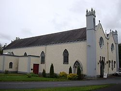
- Protected buildings
- Media
- Education
- Rail
- Twin towns
- Sports
- People
- References
Map of Ballyhaunis, Co. Mayo, Ireland
It is thought that the town grew up around St Mary's Augustinian Friary (popularly referred to as "the Abbey"), which was founded in 1348, according to local tradition. The town and its hinterland is steeped in history and contains many megalithic monuments.
In the 2011 Census, Ballyhaunis had a population of 2,312. Non-Irish nationals make up 42% of its population, which is much higher than the national average and is the highest of any town in Ireland. Poles and Pakistanis make up the largest groups of immigrants. Meanwhile, White Irish people make up 40% of the population. There are two Catholic churches in the town and it is also home to Ireland's only purpose-built mosque outside Dublin. Farming, private business and industry are the main sources of employment.
Ballyhaunis is within both the Roman Catholic and civil parishes of Annagh.
Mayo day ballyhaunis 2016
War of Independence
On 2 August 1920, during the Irish War of Independence, the Irish Republican Army (IRA) ambushed a British Army lorry on the Claremorris road from Ballyhaunis, seizing weapons and ammunition. A high cross marks the spot of the ambush. On 1 April 1921, Sean Corcoran, O/C of the IRA's East Mayo Brigade, was shot dead by British soldiers after a short gunfight at Crossard crossroads (6 km north of Ballyhaunis). A high cross marks the spot where Corcoran died. Later that same day, a member of the British Black and Tans was killed by a sniper. In retaliation, the Black and Tans executed Michael Coen, a man that was later proven not to have taken part in fighting of any kind. A monument to Coen was placed on the Cloonfad/Galway road from Ballyhaunis.
Protected buildings
According to Mayo County Council, four buildings in the town are protected under Part IV of the Planning and Development Act 2000. These include:
Media
Education
The two original primary schools in the town, St. Mary's Boys' National School and St. Joseph's Girls' National School, were merged to form Scoil Íosa National School, a single co-educational school. Three post-primary schools, St. Joseph's Convent Secondary School, Ballyhaunis Vocational School, and St. Patrick's College, were merged to form Ballyhaunis Community School which opened in September 1977.
Rail
Ballyhaunis railway station is a station on the Dublin to Westport Rail service. Passengers to or from Galway travel to Athlone and change trains. Passengers to or from Ballina and Foxford travel to Manulla Junction and change trains.
Ballyhaunis railway station opened on 1 October 1861 and its 150th anniversary was celebrated by a Ballyhaunis Railway Station-themed edition of the local Annagh Magazine in 2011.
Twin towns
Ballyhaunis was twinned with the town of Guilers in Brittany in 1984.