
Country Canada Website [2] Population 1,334 (2016) Local time Saturday 6:46 AM | Time zone PST (UTC−8) Area 253 ha | |
 | ||
Weather -1°C, Wind N at 18 km/h, 99% Humidity | ||
Lions Bay is a residential community on the Sea-to-Sky Highway, approximately midway between West Vancouver and Squamish. The 35th smallest of BC's 264 self-governing municipalities, Lions Bay is located on the steep eastern shore of Howe Sound.
Contents
- Map of Lions Bay BC Canada
- One of the beaches at lions bay bc
- Background
- Location
- Governance
- Amenities
- Infrastructure
- Demographics
- Public Transit
- Lions Bay School
- Lions Bay Search and Rescue
- References
Map of Lions Bay, BC, Canada
One of the beaches at lions bay bc
Background
Originally a summer camping destination for Vancouverites, Lions Bay began to be settled for permanent residences in the 1960s, with poor road access to Vancouver. Initially only a water improvement district, the Village was incorporated in 1971.
Location
Lions Bay is less than 30 minutes driving time south to downtown Vancouver. The Lions Bay General Store and Cafe, two realty offices, and a Post Office are located centrally.
Governance
Lions Bay is a small self-governing municipality in British Columbia, with elected Mayor and four Councillors setting policy. Five administrative staff work out of the municipal hall, and four at the Frank Smith Works (maintenance) yard. The Village's Klatt Public Safety Building houses the 30-volunteer Fire Department, an ambulance station leased to the BC Ambulance Service, and Lions Bay Search & Rescue.
Lions Bay is a member of the Metro Vancouver Regional District.
Policing is provided by the Squamish RCMP detachment.
Amenities
Lions Bay Beach Park has restroom and change facilities (slated for refurbishment in 2017), a sandy beach protected by floating log boom, and a float. Kelvin Grove Beach park is 500 meters south.
A large private marina has land-storage capacity for approximately 200 boats of up to 32 feet, and a forklift/trailer launch and recovery ramp.
Infrastructure
Under permit from the Province water service is drawn from Harvey and Magnesia Creeks, and treated in two modern dual-barrier (UV and chlorine) plants. Other than a few weeks in late summer, the Village's supply from its own creeks is more than adequate. Other than the 100 houses in the Kelvin Grove area, Lions Bay does not have central sewage, but relies on individual onsite wastewater systems (previously termed septic systems).
Demographics
In the Canada 2016 Census, Lions Bay's population was 1,334, making it the 38-smallest municipality in BC (the Canadian census only counts citizens and permanent residents). At the 2015 property tax assessment, the Village's 552 private properties, almost all large single-family dwellings, had an average value of $1,039,000, the 6th highest in BC. Combined property tax, parcel tax and user fees averaged $6,384 per property, the 5th-highest in the province. Lions Bay has a land area of 2.53 square kilometers.
Public Transit
As part of the regional TransLink public transit network, Lions Bay is served by the C12 and 259 routes, which run approximately hourly.
Lions Bay School
The public K-3 Lions Bay Community School is part of BC School District 45 (West Vancouver) and opened in 1977, with a joint-use school field installed in 1989. Enrollment at the school varies between 40 and 60 students. After Grade 3, students mostly move on to the K-7 Gleneagles Ch'axáý Elementary School in Horseshoe Bay and then to Rockridge High School at Caulfeild; the school district provides school bus service.
Lions Bay Search and Rescue
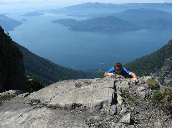
The Lions Bay Search and Rescue team was established in the early 1980s following a series of landslides which caused a number of deaths and briefly cut the highway and isolated the Village. Although initially set up to provide the Village with a measure of self-sufficiency in an emergency, the Search and Rescue team developed over time into a primarily mountain rescue group. The twin peaks above the Village give it its name, and are known in First Nations stories as The Sisters and in latter days as The Lions. The Lions are prominently visible from Vancouver, and attract large numbers of hikers and climbers, especially in warmer months. Hiking trails in the area of the Lions are rough and demanding (a hike from Lions Bay to the top of the West Lion gains 1500 meters in elevation with a round trip travel time of 6–8 hours for fit hikers). Every year an increasing number of hikers are injured, lost or caught out in the dark while hiking in this area. This has necessitated the development of Lions Bay Search and Rescue as a volunteer mountain rescue group in association with the Provincial Emergency Program.