
Country Indonesia Time zone WIB (UTC+7) Population 86,230 (2010) | Capital Daik Area 2,206 km² Province Riau Islands | |
 | ||
Not to be confused with "Linga", a common Scottish island name, see Linga (disambiguation)
Contents
Map of Lingga Islands, Indonesia
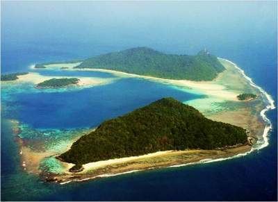
The Lingga Islands or Lingga Archipelago (Indonesian: Kepulauan Lingga) are a group of islands in Indonesia, located south of Singapore, along both sides of the equator, off the eastern coast of Riau Province on Sumatra island. They are south of the populated Riau Archipelago, known for the industrial island of Batam and the tourist-frequented island of Bintan, although the Lingga Islands themselves are rarely visited due to the infrequent local transportation. The equator goes through the northern tip of Lingga, the name of the main island in the archipelago. Administratively they form a Regency of the Riau Islands Province with an area of 2,205.95 km² and a population of 86,150 people at the 2010 Census. The capital lies at Daik.
The population are mainly Malay, Bugis and Chinese (predominantly Hakka, Teochew and Hokkien).
Name
Lingga derives its name from the profile of Mount Daik which is shaped like the Hindu lingam, often interpreted as a phallic symbol. This mountain has three sharp teeth as peak, one of them seems to have broken off at its base, and it was immortalised by Malay poets as the symbol of durability. The poem is
Pulau Pandan jauh ke tengah,
Gunung Daik bercabang tiga,
Hancur badan dikandung tanah,
Budi yang baik dikenang juga.
Nearby are the remains of the fort of Benteng Bukit Cening, overlooking the sea. The cannons are still lined up, as if they were awaiting another enemy attack.
Islands
By size and population the most important islands in the archipelago are Lingga and Singkep, then Sebangka and Bakung.
Administration
The Regency is divided into five districts (kecamatan) – tabulated below with their 2010 Census population:
Transport
Ferry services to the islands from outside the archipelago come from the provincial capital to the north, Tanjung Pinang on Bintan, including from Singapore. These days the main industry is fishing. There are a number of fine beaches with some coral around the Archipelago but there is very little tourism on account of the poor transport links with the outside world.
Lingga Roads
Lingga Roads is an anchorage in the Lingga Islands, south of Lingga Island and northwest of Singkep. During World War II, Lingga Roads was used as a fleet anchorage by major units of the Imperial Japanese Navy, in order that these ships be near a source of fuel. It was from Lingga Roads that the main Japanese southern striking force deployed for the Battle of Leyte Gulf.