Time zone CET (UTC+1) Website www.lingewaard.nl Local time Saturday 9:55 AM | Elevation 11 m (36 ft) Area code 026, 0481 Area 69.14 km² | |
 | ||
Postcode 6680–6681, 6684–6691, 6850–6852 Weather 11°C, Wind W at 23 km/h, 91% Humidity Points of interest Doornenburg Castle, Fort Pannerden, Mea Vota | ||
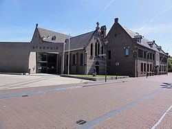
Lingewaard ( pronunciation ) is a municipality in the eastern Netherlands. It is located in the most eastern part of the Betuwe. It was formed in 2001 as a merger between Bemmel, Gendt and Huissen. The municipality was initially named Bemmel after the largest former municipality but later renamed in a referendum. "Lingewaard" itself is not a population centre, but an artificial name favoured by the majority of the voters. The municipality lies in between of the cities of Nijmegen and Arnhem, where most inhabitants work.
Contents
Map of Lingewaard, Netherlands
Population centres
The municipality has the following population centres:
Bemmel also includes the hamlet and former village of Doornik. Gendt includes Hulhuizen.
Notable residents
Notable people from the municipality of Lingewaard include:
Twin towns
Lingewaard is twinned with:
