
River mouth Loire460 m (1,510 ft) Basin size 661.3 km (255.3 sq mi) Basin area 661.3 km² | Length 84 km | |
 | ||
Main source Chaudeyrolles1,440 m (4,720 ft) Discharge Average rate:9.8 m/s (350 cu ft/s) | ||
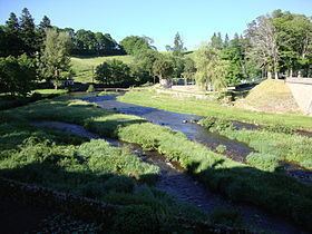
The Lignon du Velay (French: le Lignon du Velay) is a 84.5-kilometre (52.5 mi) long river in the Ardèche and Haute-Loire départements, south-central France. Its source is near Chaudeyrolles. It flows generally north. It is a right tributary of the Loire into which it flows at Pont de Lignon, a hamlet in Monistrol-sur-Loire.
Contents
Map of Le Lignon, France
Départements and communes along its course
This list is ordered from source to mouth:
References
Lignon du Velay Wikipedia(Text) CC BY-SA