
Population (1999) 1,253 Area 30.75 km² | Canton Yssingeaux Time zone CET (UTC+1) Local time Sunday 8:29 PM | |
 | ||
Weather 8°C, Wind NW at 5 km/h, 86% Humidity | ||
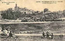
Lapte is a commune in the Haute-Loire department in south-central France, located 23 kilometres southwest of the city of Firminy. Its inhabitants, called laptois and laptoises, count at 1515, with a density of 49.3 inhabitants per square kilometre. Lapte is surrounded by the communes Grézac, Chenereilles and Raucoules.
Contents
Map of 43200 Lapte, France
Geography
The municipality of Lapte covers 30.8 square kilometres. It is located at 860 metres above the Lignon du Velay river, where it converges with the Denieres . The river Lignon du Velay also flows through the commune.
References
Lapte Wikipedia(Text) CC BY-SA