
Airport type Public Elevation AMSL 98 ft / 30 m 3,698 1,127 Elevation 30 m | 14/32 3,698 Address Hinesville, GA 31313, USA | |
 | ||
Similar MidCoast Regional Airport, Liberty County Airport‑2J2, Liberty County Animal C, Liberty County Informatio, Emergency Manage Office | ||
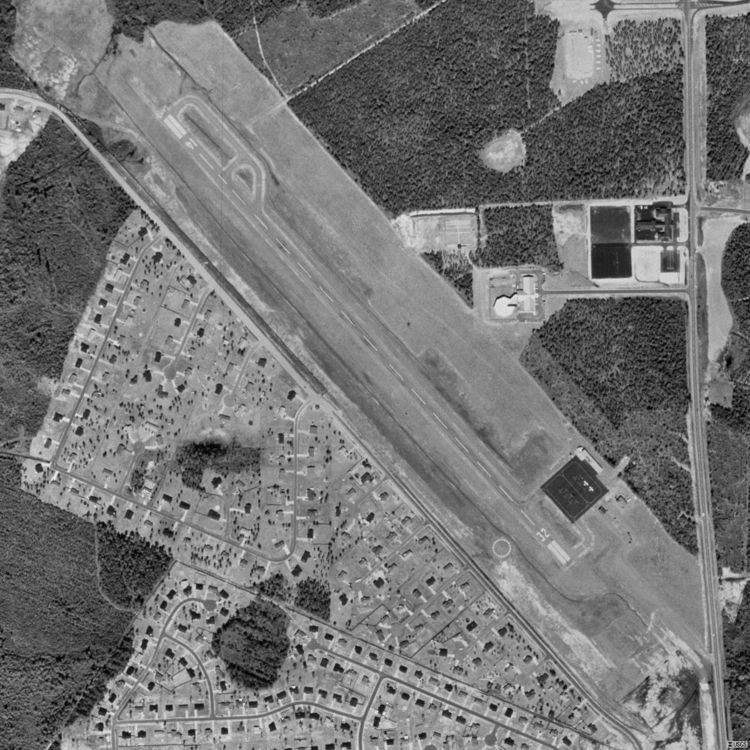
Liberty County Airport (FAA LID: 2J2) is a county-owned public-use airport in Liberty County, Georgia, United States. The airport is located five nautical miles (9 km) south of the central business district of City of Hinesville.
Facilities and aircraft
Liberty County Airport covers an area of 77 acres (31 ha) at an elevation of 98 feet (30 m) above mean sea level. It has one runway designated 14/32 with an asphalt surface measuring 3,698 by 75 feet (1,127 x 23 m). For the 12-month period ending July 18, 2006, the airport had 4,000 general aviation aircraft operations, an average of 10 per day.
Liberty County Airport was permanently closed in 2008 when Wright Army Airfield was opened to civilian traffic.
References
Liberty County Airport (Georgia) Wikipedia(Text) CC BY-SA