
 | ||
1 lezayre avenue bridgewater
Lezayre ("garden of the island") is a parish in the Sheading of Ayre and lies central and north in the Isle of Man. The parish is bounded by Michael and Ballaugh to the west, Andreas and Bride to the north, the town of Ramsey and the parishes of Lonan and Maughold to the east, and Braddan to the south. Its area is about 57 square kilometres (22 sq mi).
Contents
The population according to the 2006 census is 1,237 (1,134 in 2001)
Lezayre is primarily rural and mountainous, and includes the summit of Snaefell, the highest point of the island, and much of the mountain sections of the TT course. It also includes most of the course of the Sulby river, the longest river on the island. Most of the settlement in the parish is stretched along the main road from Ramsey towards Peel, including the village of Sulby.
2011 scottish widows parish walk robbie at lezayre
Churches
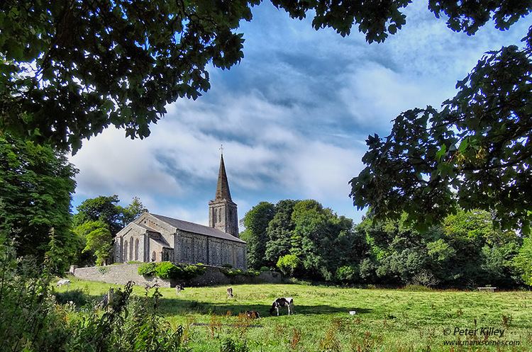
The Church of England parish church of Kirk Christ, Lezayre was built in 1835. In 2013, it was closed and the diocese is looking to sell the building. There are two other Church of England churches in the parish, St. Stephen's, Sulby and St. Fingan's, a small converted Methodist chapel in Glen Auldyn.
Sulby has a prominent Methodist church.