
Time zone CET (UTC+1) Area 6.11 km² | Region Île-de-France Population (2006) 17,255 INSEE/Postal code 78165 / Local time Wednesday 11:18 PM | |
 | ||
Weather 8°C, Wind W at 3 km/h, 85% Humidity | ||
Football les clayes sous bois toujours en course pour en gambardella
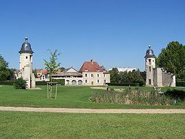
Les Clayes-sous-Bois is a commune in the Yvelines department in the Île-de-France region in north-central France. It is located in the western suburbs of Paris 26.7 km (16.6 mi) from the center.
Contents
- Football les clayes sous bois toujours en course pour en gambardella
- Map of 78340 Les Clayes sous Bois France
- Football les clayes sous bois s arr tent au 6e tour de la gambardella
- Transport
- Education
- References
Map of 78340 Les Clayes-sous-Bois, France
Football les clayes sous bois s arr tent au 6e tour de la gambardella
Transport
Les Clayes-sous-Bois is served by Villepreux – Les Clayes station on the Transilien Paris – Montparnasse suburban rail line.
Education
Preschools
Primary schools:
The commune has two junior high schools: La Fosse aux Damnes and Anatole France. Lycée Jean-Vilar in Plaisir and Lycée Sonia Delaunay in Villepreux are nearby.
References
Les Clayes-sous-Bois Wikipedia(Text) CC BY-SA