
- land 0.34 km (0 sq mi) - summer (DST) EDT (UTC-4) Local time Wednesday 7:18 AM | - water 0.01 km (0 sq mi) Area 35 ha Population 166 (2013) | |
 | ||
Weather -8°C, Wind W at 18 km/h, 72% Humidity | ||
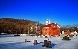
Lenhartsville is a borough in Berks County, Pennsylvania, United States. The population was 165 at the 2010 census.
Contents
Map of Lenhartsville, PA 19534, USA
Geography
Lenhartsville is located in northern Berks County at 40°34′24″N 75°53′12″W (40.573438, -75.886717), in the valley of Maiden Creek. It is surrounded by Greenwich Township but is separate from it.
According to the United States Census Bureau, Lenhartsville has a total area of 0.14 square miles (0.35 km2), of which 0.004 square miles (0.01 km2), or 2.75%, is water.
Demographics
As of the census of 2000, there were 173 people, 78 households, and 47 families residing in the borough. The population density was 1,296.6 people per square mile (513.8/km²). There were 82 housing units at an average density of 614.6 per square mile (243.5/km²). The racial makeup of the borough was 100.00% White. Hispanic or Latino of any race were 0.58% of the population. Historically there is a large Pennsylvania Dutch population.
There were 78 households, out of which 23.1% had children under the age of 18 living with them, 53.8% were married couples living together, 7.7% had a female householder with no husband present, and 38.5% were non-families. 28.2% of all households were made up of individuals, and 14.1% had someone living alone who was 65 years of age or older. The average household size was 2.22 and the average family size was 2.73.
In the borough the population was spread out, with 17.3% under the age of 18, 8.7% from 18 to 24, 31.2% from 25 to 44, 26.0% from 45 to 64, and 16.8% who were 65 years of age or older. The median age was 37 years. For every 100 females there were 96.6 males. For every 100 females age 18 and over, there were 93.2 males.
The median income for a household in the borough was $36,071, and the median income for a family was $36,964. Males had a median income of $35,000 versus $20,500 for females. The per capita income for the borough was $16,998. About 9.4% of families and 9.8% of the population were below the poverty line, including 7.1% of those under the age of eighteen and 8.3% of those sixty five or over.
History
Heinrich (Henry) Lenhart, 1773–1837, son of Jacob Lenhart, is considered the founder of Lenhartsville, on land once owned by his grandfather Johan Peter Lenhart.
The Lenhart Farm was listed on the National Register of Historic Places in 1978.
Transportation
The Interstate 78/U.S. Route 22 freeway passes just north of the borough, with access from Exit 35 (Pennsylvania Route 143). I-78/US 22 leads east 23 miles (37 km) to Allentown and west 59 miles (95 km) to Harrisburg. PA 143 leads south 8 miles (13 km) to U.S. Route 222 between Kutztown and Reading, and northeast 13 miles (21 km) to New Tripoli.