
Country United States FIPS code 29-41438 Elevation 144 m Population 16,645 (2010) | Time zone Central (CST) (UTC-6) GNIS feature ID 0765705 Zip code 63125 Area code 314 | |
 | ||
Area 11.65 km² (11.14 km² Land / 52 ha Water) | ||
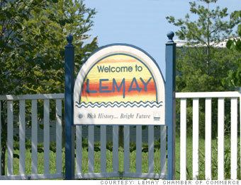
Lemay is a census-designated place (CDP) in St. Louis County, Missouri, United States. The population was 16,645 at the 2010 census.
Contents
Map of Lemay, MO 63125, USA
History
Lemay was named after Francois Lemai, who operated a ferry boat across the Meramec River in the early nineteenth century.
Geography
Lemay is located at 38°31′57″N 90°17′7″W (38.532552, -90.285332).
According to the United States Census Bureau, the CDP has a total area of 4.5 square miles (12 km2), of which 4.3 square miles (11 km2) is land and 0.2 square miles (0.52 km2), or 4.19%, is water.
Demographics
As of the census of 2000, there were 17,215 people, 7,186 households, and 4,390 families residing in the CDP. The population density was 3,959.0 people per square mile (1,528.0/km²). There were 7,580 housing units at an average density of 1,743.2/sq mi (672.8/km²). The racial makeup of the CDP was 98.51% White, 0.02% African American, 0.007% Native American, 0.53% Asian, 0.01% Pacific Islander, 0.66% from other races, and 0.96% from two or more races. Hispanic or Latino of any race were 1.03%.
There were 7,186 households out of which 26.5% had children under the age of 18 living with them, 43.6% were married couples living together, 12.6% had a female householder with no husband present, and 38.9% were non-families. 34.3% of all households were made up of individuals and 16.8% had someone living alone who was 65 years of age or older. The average household size is 2.33 and the average family size was 2.99.
In the CDP, the population was spread out with 22.8% under the age of 18, 7.7% from 18 to 24, 27.9% from 25 to 44, 21.4% from 45 to 64, and 20.1% who were 65 years of age or older. The median age was 39 years. For every 100 females there were 89.8 males. For every 100 females age 18 and over, there were 84.0 males.
The median income for a household in the CDP was $34,559, and the median income for a family was $41,128. Males had a median income of $31,886 versus $25,388 for females. The per capita income for the CDP was $18,730. About 7.1% of families and 10.4% of the population were below the poverty line, including 13.2% of those under the age of 18 and 11.3% of those ages 65 and older.
Economy
The River City Casino is located in Lemay.
Schools
Hancock is the primary school district in Lemay. Hancock enrolls approximately 1600 students. Hancock High School is located at 229 West Ripa Ave. Hancock Middle School is located at 243 West Ripa Ave. Hancock Elementary School is located at 9101 South Broadway Ave. Hancock Early Childhood Center is located at 9417 South Broadway Ave.