
Average depth 12.4 m (41 ft) Surface elevation 2,616 m Mean depth 12 m | Primary outflows Ova da la Tscheppa Surface area 7.96 ha (19.7 acres) Max. depth 32 m (105 ft) Area 8 ha | |
 | ||
Similar Piz Polaschin, Alps, Piz Grevasalvas, Piz Lagrev, Hahnensee | ||
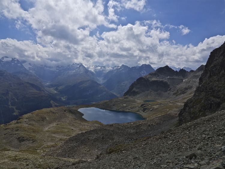
Lej da la Tscheppa is a lake above Sils Maria, in the Engadine valley of the Grisons, Switzerland. Its surface area is 7.96 ha (19.7 acres) at an elevation of 2616 m. It used to be fed by water from the Crasta-Tscheppa Glacier (melted in 2003).
Contents
Map of Lej da la Tscheppa, 7514 Sils im Engadin%2FSegl, Switzerland
Lej da la tscheppa
References
Lej da la Tscheppa Wikipedia(Text) CC BY-SA