
OS grid reference TQ394807 Sovereign state United Kingdom Dialling code 020 | Postcode district E14 | |
 | ||
Leamouth final wmv
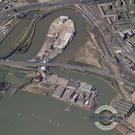
Leamouth is the land, traditionally in Poplar, immediately west of the River Lea where it joins the River Thames at grid reference TQ394807. Its northern half lies within a small meander of the Lea named after its reach as Goodluck Hope. The south-eastern part, known as Orchard Place is bounded by a local thoroughfare with trees, the remaining small East India Dock Basin, the Lea and the Thames.
Contents
Eduscrape leamouth video 2010
Transport
It forms an L-shaped peninsula which is connected to east and west by a main road splitting its halves: the Lower Lea Crossing which is a local by-pass of the A13.
History
This was traditionally the easternmost part of Middlesex and its economy closely mirrored that of neighbouring riverside Blackwall.
The area has never had its own Anglican church so for services such as road maintenance organised by a vestry and poor relief it relied upon its ecclesiastical parish (of All Saints) Poplar. Indeed, the whole Isle of Dogs was until the late 20th century referred to as being Poplar or the Poplar District.
Orchard Place was the name of its manor house on the spit; this had become an eponymous public house from 1800–60. When the docks were constructed, the area became isolated, with the only access via the dock road, from Poplar. Residents were engaged at the glass works, the iron and engineering works, or the Samuda Brothers, Orchard House Yard and Thames Iron Works ship yards. When the Thames Plate Glass Works closed in 1874, many of the hands – who had migrated to the area from Tyneside and St Helens in the 1840s – followed the glassworks to New Albany, Indiana. To house the workers, there were about 100 small two-storied cottages – built from the 1820s and condemned in 1935. There was the Bow Creek school (founded in 1865), but few shops, and The Crown, a public house, opened about 1840.
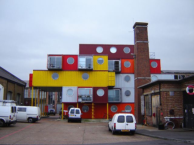
One street, Orchard Place, runs through the former industrial area and the Lower Lea Crossing crosses the narrow strip of land between the two tongues. The northern part was principally occupied by Pura Foods Ltd vegetable oil refinery – on the site of the former Thames Plate Glass Works; and the south by engineering works, shipyards (Thames Iron Works and Orchard House Yard) and Trinity Buoy Wharf which contains London's only lighthouse. There are also live-work units, many in the form of the Container Cities. The "Jubilee" pedestrian bridge across the Lea links the area to the east bank of the Lea, and Canning Town station.
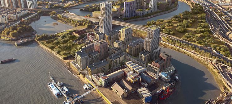
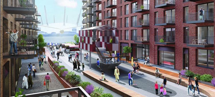
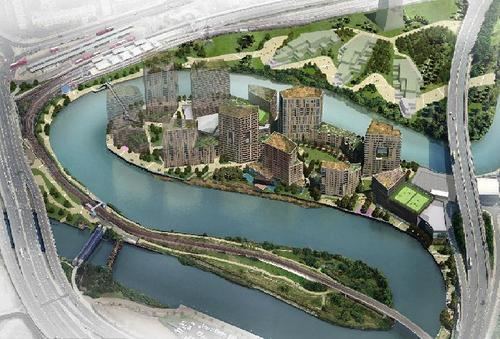
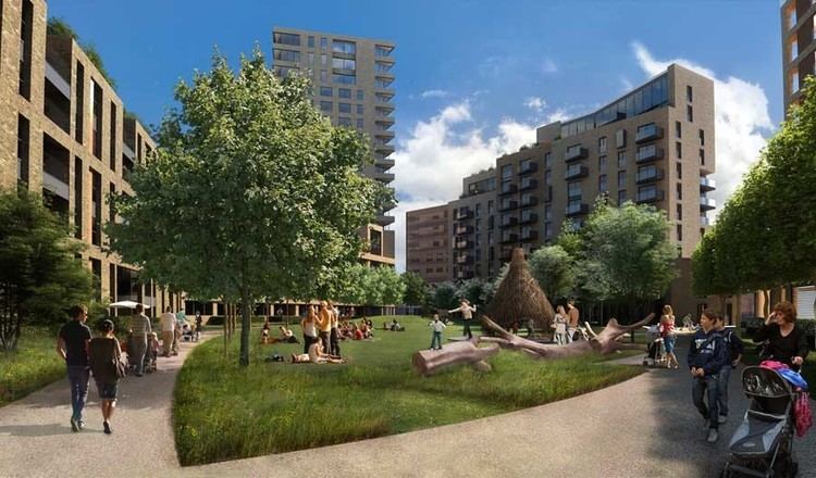
Plans
The Leamouth Peninsula project is a scheme by architects Skidmore, Owings and Merrill that has received planning permission to create up to 1837 homes, a community centre, an arts centre, and a primary school with places for up to 371 children on the peninsula. The 1,900,000 square feet (176,516 m2) scheme will consist of extremely high density housing around a central core pedestrian route linking to the proposed lower Lea Valley linear Park - leading to the 2012 Olympic Park. Leamouth will have beside its limited belt of trees which are to be retained or replaced, a mixture of towers, from 44 metres (144 ft) to 85 metres (279 ft) in height. The scheme will be implemented in two phases, one north of the single access road to the site, the other to the south, around Trinity Buoy Wharf. Construction work began, but was suspended in early 2009 due to the downturn in the housing market.