
Population (2006) 6,386 Area 3.27 km² | Region Île-de-France Time zone CET (UTC+1) Local time Tuesday 5:38 AM | |
 | ||
Weather 3°C, Wind SW at 3 km/h, 92% Humidity | ||
Le Mesnil-le-Roi is a commune in the Yvelines department in the Île-de-France region in north-central France. It is about 8 km (5 mi) from Saint-Germain-en-Laye.
Contents
- Map of Le Mesnil le Roi France
- Geography
- Heraldry
- Culture
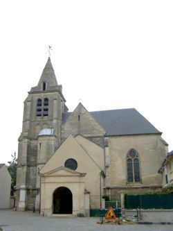
- Monuments
- Twin towns
- Famous people
- Economy
- References
Map of Le Mesnil-le-Roi, France
The name "Mesnil" comes from Latin: mansionilis meaning "little estate". The name "Le Mesnil-le-Roi" could be said "The King's small estate" (Francis I). On the other hand, the name of Mesnil-le-Roi in the time of the French Revolution was Le Mesnil-Carrières, "Mesnil quarries".
The inhabitants are called Mesnilois (male) and Mesniloise (female).
Geography
Le Mesnil-le-Roi is situated between the Forest of Saint-Germain-en-Laye and the left bank of the River Seine. It is bordered by Maisons-Laffitte to the north, Le Pecq to the south and Saint-Germain-en-Laye to the west. To the east, the Seine separates it from Montesson. The communal land includes an equal part of an island in the Seine, the Île de la Borde.
Outside the town, conjoining with Maisons-Laffitte, the commune includes a second major estate, Carrières-sous-Bois.
The commune is crossed in its southern part by the A14 autoroute, partly underground. This autoroute crosses the Seine on a viaduct of reinforced concrete, forming two parallel bridges.
Heraldry
This coat of arms, adopted in 1952, derives from the La Salle family, the ancient landowners of Carrières-sous-Bois, and it was given to them by Francis I.
Culture
The town participates in a Concours des villes et villages fleuris ("Towns and Villages in Bloom" competition) and in 2007 won two flowers.