
Canton Nogent-le-Roi Area 10.92 km² | Intercommunality Drouais | |
 | ||
Le Boullay-Mivoye is a commune in the Eure-et-Loir department in northern France.
Contents
Map of Le Boullay-Mivoye, France
Geography
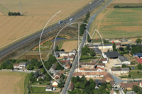
The village is positioned on flat land along the RN154 between Dreux and Chartres, a little closer to the former than to the latter.
History
A standing stone testifies to the existence of human settlement in prehistoric times, and the remains of various farms from the Roman and Gallo-Roman periods have also been found in the vicinity.
During the Revolution there was across France a resurgence of enthusiasm for the Gallo-Roman period, and Le Boullay-Mivoye was for a time called Le Boullay-Brutus.
References
Le Boullay-Mivoye Wikipedia(Text) CC BY-SA