Time zone CET (UTC+1) Website www.leanyfalu.hu Population 3,159 (2007) Area code 26 | Postal code 2016 Area 15.37 km² Local time Thursday 8:00 PM | |
 | ||
Weather 12°C, Wind NW at 14 km/h, 42% Humidity | ||
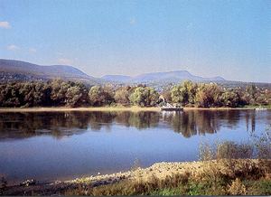
Leányfalu is a riverside village in Pest county, Budapest metropolitan area, Hungary. It is just north of Szentendre located at 47°43′36″N 19°5′22″E. Located between the branch of the Small Danube (Kis-Duna) and the spurs of the Visegrád Hills, Leányfalu stretches some 5 kilometres in length. It was declared a holiday resort in 1936 and became an independent municipality in 1949.
Contents
Map of Le%C3%A1nyfalu, 2016 Hungary
To visit Leányfalu from Budapest, take the local Volán buses on the Budapest Újpest Városkapu – Tahitótfalu – Visegrád – Esztergom line, which leaves around one to three times per hour. By automobile, take route 11 passing through Szentendre.
Trivia
References
Leányfalu Wikipedia(Text) CC BY-SA
