
Time zone CET (UTC+1) Area 2,538 km² | Website Official website | |
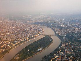 | ||
The Budapest metropolitan area (Hungarian: Budapesti agglomeráció) is a statistical area that describes the reach of commuter movement to and from Budapest and its surrounding suburbs. Created by Hungary's national statistical office HCSO to describe suburban development around centres of urban growth, the surrounding a more densely built and densely populated urban area. As of 2014 the Budapest metropolitan area, with its 7,626 km² (2,944 sq mi), extends significantly beyond Budapest's administrative region (encompasses 193 settlements around the city), a region also commonly referred to as Central Hungary. It had a population of 3,303,786 inhabitants at the January 2013 census, making it the tenth largest urban region in Europe (Larger urban zones in Europe). 33% of Hungary's population resides in the region.
Contents
Map of Budapest Metropolitan Area, Hungary
Traffic
There are 4 subway lines, 36 tram lines, 18 suburban railway lines (operated by MÁV-Hungarian State Railways and BKV-Public Transport Company of Budapest also) and 601 bus lines in the metropolitan area (2006).