
Comarca Nalón Highest elevation 1,560 m (5,120 ft) Area 131 km² | Autonomous community Asturias Capital Pola de Laviana Demonym(s) lavianés Local time Monday 7:59 PM | |
 | ||
Weather 10°C, Wind N at 10 km/h, 86% Humidity Points of interest Casa natal de Armando Palacio Valdes, Area recreativa Campa Felguera, El Robledal, El Torreón | ||
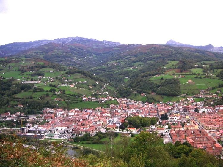
Laviana (Asturian: Llaviana) is a municipality in the Autonomous Community of the Principality of Asturias, located in Spain. It is bordered on the north by Bimenes and Nava, on the south by Aller, on the east by Piloña and Sobrescobio, and on the west by San Martín del Rey Aurelio and Mieres.
Contents
- Map of Laviana Asturias Spain
- Economy
- History
- Coat of arms
- Points of interest
- Fiesta and feria
- Parroquias parishes
- Famous people
- References
Map of Laviana, Asturias, Spain
Situated in the basin of the Rio Nalon, it is a terminal for the FC de Langreo railway, now subsumed by FEVE, which connects it to the port of Gijón.
Economy
Mining, agriculture and stock-rearing have been the principal industries since the early 20th century.
History
Almost everywhere in Asturia you find Prehistorian Signs, also in the region Laviana. Some Hill Forts and Dolmen made in the Bronze Age and in the Iron Age are still visitable (Castro de El Cercu, El Prau in Castiello and La Corona in Boroñes).
Also the Romans built some Bridges along the Rio Nalon Street which are used today.
The name Flaviana was written down first time, in 1115 when the area was bordered to the Monastery "San Vicente de Oviedo".
During the Peninsular War and the Carlism revolution, Laviana was the area for some famous battles.
Coat of arms
Points of interest
Fiesta and feria
Almost every month, there are some special events in the region, the important dates you find on the website ´´Fiestas´´