
Elevation 2,177 m | Prominence 33 m | |
 | ||
Parent range Daumen Group, Allgäu Alps Similar Schneck, Höfats, Schochen, Hochvogel, Lachenkopf | ||
Wanderung laufbacher eck
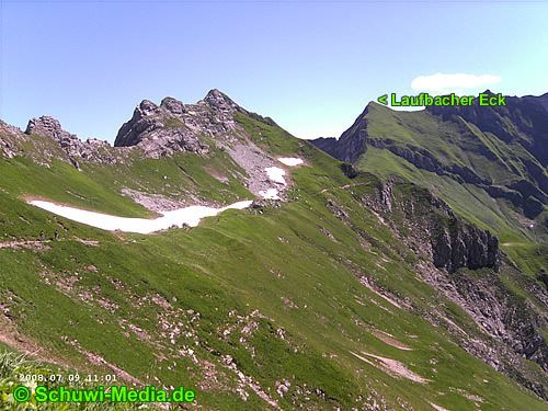
The Laufbacher Eck is a 2,178-metre-high grass mountain in the Allgäu Alps in the south German state of Bavaria.
Contents
- Wanderung laufbacher eck
- Map of Laufbacher Eck 87561 Bad Hindelang Germany
- LocationEdit
- LiteratureEdit
- References
Map of Laufbacher Eck, 87561 Bad Hindelang, Germany
LocationEdit
It is located southeast of the Lachenkopf and north of the Rotkopf from which it is separated by the Laufbachereck Saddle. The mountain trail from the Edmund-Probst House to the Prinz-Luitpold-Haus runs over the saddle. On the Laufbacher Eck, a side ridge, on which are the peaks of Salober, Berggächtle and Giebel, branches off to the northeast. The Laufbacher Eck can be reached easily from the Laufbachereck Saddle in a few minutes. The botany of the Laufbacher Eck is similar to that of the Höfats or Schneck. Hence the mountain rescue service supports the protection of botanical rarities as they do on the Höfats during the summer months.