
 | ||
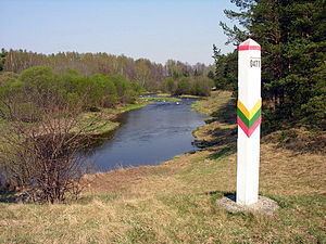
The Latvia–Lithuania border is the state border between Latvia and Lithuania. The length of the land border is 588.1 kilometres (365.4 mi) with additional 22.2 kilometres (13.8 mi) of sea border.
Contents
The border starts from the triple junction of the borders with Belarus to the north of Lake Drūkšiai (55°40′50.17″N 26°37′49.79″E) and stretches to the coast of the Baltic Sea, where it ends between Palanga and Rucava. For 30 kilometres (19 mi) the border follows the Šventoji River.
History
The border started to exist in 1918, when independence was declared by both states. There were some disputes on the exact location of the border but these were settled after a few years. These disputes related to places where the old Russian province borders did not follow the language distribution, and to railways.
The border became partially defunct at incorporation into the Soviet Union, since it became an internal state border. At that time it was extended, since the Vilnius area was reincorporated into Lithuania. The international border was restored at independence in 1991. After prolonged negotiations, in July 1999, the border between territorial waters was drawn as a straight line between 56°04′08.9″N 21°03′51.47″E and 56°02′43.5″N 20°42′35.0″E.
Border crossing
Both countries are members of the Schengen area, so border control is not carried out and the border can be crossed anywhere. They joined the Schengen area in 2007. Between 1991 and 2007 there were border checkpoints between the countries, which are now abandoned.