
NRHP Reference # 67000007 Area 4.047 km² Year built 1850 | Designated NHLD May 28, 1967 Local time Sunday 7:04 PM Added to NRHP 28 May 1967 | |
 | ||
Weather 13°C, Wind NW at 26 km/h, 19% Humidity | ||
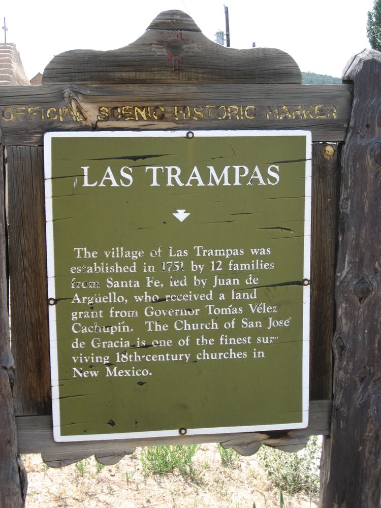
Las Trampas or Trampas (Spanish, "traps") is a small unincorporated town in Taos County, northern New Mexico, the Southwestern United States.
Contents
Map of Trampas, NM 87521, USA
Geography
Las Trampas is located on the scenic High Road to Taos (New Mexico State Road 76) in the Sangre de Cristo Mountains, it is approximately halfway between Santa Fe to the south and Taos to the north.
The town has a post office, with the ZIP code 87576; the US Postal Service prefers the name "Trampas". No ZIP Code Tabulation Area information for 87576 is available from Census 2000.
History
Founded in 1751 by twelve Spanish families from Santa Fe, the town is known for the San José de Gracia Church, built between 1760 and 1776 and considered a model of the adobe colonial Spanish missions in New Mexico. The church was once used by Los Hermanos Penitentes, a flagellant Catholic order founded in Spanish era Santa Fe de Nuevo México.
Las Trampas National Historic District
The Las Trampas Historic District was established by the National Park Service (NPS) in 1967. The San José de Gracia Church was designated a National Historic Landmark in 1970. It is on the National Register of Historic Places in Taos County, New Mexico.