
 | ||
Restaurants Tail Up Goat, Mama Ayeshas Restaurant, El Nuevo Migueleño, Pho 14, Latin Alley | ||
6189 lanier heights rd buford ga
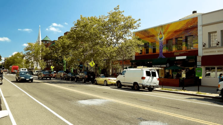
Lanier Heights is a small urban neighborhood located in the northwest section of Washington, D.C., and is one of the early subdivisions which were created within the District of Columbia, but which lay outside of the original, officially-planned City of Washington. Situated two miles north of the White House, Lanier Heights is within the larger and newer neighborhood of Adams Morgan, and is usually considered to be a part of that more prominent locale. The area of Lanier Heights, about 45 acres (18.2 hectares) in size, is bounded by 16th Street on the east, Adams Mill Road and the National Zoo on the west; Columbia Road to the south, and Harvard Street on the north. Developed mostly between 1900 and 1940, Lanier Heights consists primarily of row houses, plus a number of low- and medium-rise apartment buildings. The architecture is generally typical of the early twentieth century, in a variety of styles, especially Classical Revival. Some of the apartment houses have distinctive, well-crafted Art Deco designs. The area also contains a commercial stretch of stores on its southern side along Columbia Road. And just to the north of Lanier Heights is the slightly older neighborhood of Mount Pleasant.
Contents
Map of Lanier Heights, Washington, DC 20009, USA
Before the founding of Washington, D.C. in 1791, most of the land beneath Lanier Heights was originally part of a large, undeveloped piece of property granted to John Bradford in 1714, a tract which he named Plain Dealing; in 1763 this entire tract was acquired by Robert Peter of Georgetown. Additionally, a small portion of the neighborhood's land came from part of a large piece of property acquired by James Holmead in 1733. Very little occurred on the land here until after 1800. One early structure in the area was a tavern that James Eslin built in 1826, on property that he had obtained for use as a small farm. The tavern, which quickly became a popular local gambling house, was situated near the present-day intersection of 16th Street and Columbia Road. (The Eslin tract, the eastern piece of the neighborhood, was eventually developed in the 1920s.) But in general, the land that became Lanier Heights was being only lightly used—at times for common farming—until shortly after the end of the Civil War, when Washington started to grow with more vigor. For a time after the war, there was a small quarry, for construction stone and gravel, located along Rock Creek at the northern edge of the area.
The development of the neighborhood officially began in 1883 with the creation of the “Lanier Heights Subdivision", a project planned and financed by Elizabeth Lanier Dunn and her husband General William M. Dunn. This plan’s somewhat casual street configuration was laid out just a few years before Congress decreed (in 1888) that henceforth the rectangular grid system of the central city would be continued throughout the District for all new street construction. At first the new subdivision's growth was slow. Within several years banker Archibald M. McLachlen and biologist George Brown Goode of the Smithsonian Institution had, in large part, gained control of the tract with the idea of having the neighborhood become a residential community for Smithsonian employees and other professionals in Washington. In 1897 the introduction of an electric streetcar line on Columbia Road encouraged activity. Additionally, construction of the noteworthy and attractive apartment house named The Ontario (built 1902-06) brought further attention, and people, to the area. The subdivision then developed into a fairly affluent area of families and single people, including professionals, intellectuals, and city workers. In the segregated past, it was a white neighborhood, but by the 1970s it became a diverse mix of people and cultures. Recent rising home prices, however, have made it somewhat more difficult for a number of the less well-to-do residents to remain in the area.
Lanier Heights is a part of the city's Ward One. And within D.C.'s Advisory Neighborhood Commission system, the area is a part of ANC 1-C.