
Canton Hennebont Area 109.1 km² | Intercommunality Lorient Agglomération Local time Sunday 4:16 PM | |
 | ||
Weather 11°C, Wind NW at 24 km/h, 84% Humidity | ||
Languidic (Breton: Langedig) is a commune in the Morbihan department of Brittany in north-western France.
Contents
Map of 56440 Languidic, France
History
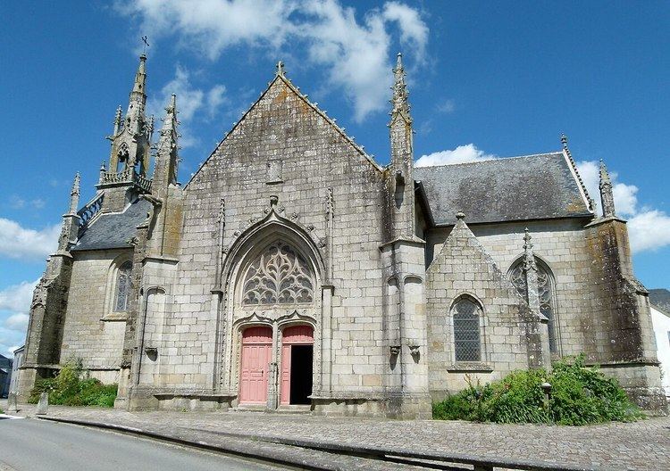
The local church was previously associated with the cult of the Welsh saint Cenydd (Kenneth).
Geography
Languidic, with his 10 908 hectares, is the most expanse city in Morbihan and the third in Brittany. The Ével forms part of the commune's north-eastern border, then flows into the Blavet, which forms its northern and north-western borders.
Demographics
Inhabitants of Languidic are called in French Languidiciens.
Breton language
In 2008, there was 18,1% of the children attended the bilingual schools in primary education. In 2013, there was 200 children in bilingual schools (primary education).
Twinning
Languidic is twinned with :
References
Languidic Wikipedia(Text) CC BY-SA