
Country United States Elevation 3,625 ft (1,105 m) Local time Saturday 4:43 PM Population 7,776 (2013) | Incorporated December 5, 1886 Time zone Mountain (MST) (UTC-7) Zip code 81052 | |
 | ||
Weather 10°C, Wind E at 16 km/h, 36% Humidity | ||
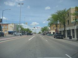
Lamar is a Home Rule Municipality that is the county seat and the most populous municipality of Prowers County, Colorado, United States. The city population was 7,804 at the 2010 United States Census. The city was named after Lucius Quintus Cincinnatus Lamar II during the period that he was Secretary of the Interior in the futile hope that the then town would be named as the land office.
Contents
- Map of Lamar CO 81052 USA
- History
- Geography and climate
- Demographics
- Public schools
- Higher education
- Rail
- Bus
- Highways
- Notable people
- References
Map of Lamar, CO 81052, USA
History
The northern site of the Pierre Auger Observatory of ultra-high energy cosmic rays is planned to be built near Lamar.
Geography and climate
Lamar is located at 38°5′10″N 102°37′10″W. According to the United States Census Bureau, the city has a total area of 4.2 square miles (11 km2), all land. Lamar is east of Pueblo, on the Arkansas River in southeastern Colorado.
Lamar is antipodal, or globally opposite, to Ile Amsterdam, an island in the southern Indian Ocean, making Lamar one of only three locations in the United States that is opposite another landmass on earth.
Demographics
As of the census of 2000, there were 8,869 people, 3,324 households, and 2,247 families residing in the city. The population density was 2,095.8 people per square mile (809.5/km²). There were 3,656 housing units at an average density of 863.9/sq mi (333.7/km²). The racial makeup of the city was 76.24% White, 0.38% African American, 1.48% Native American, 0.47% Asian, 0.05% Pacific Islander, 18.81% from other races, and 2.57% from two or more races. Hispanic or Latino of any race were 36.54% of the population.
There were 3,324 households out of which 36.0% had children living with them, 49.2% were married couples living together, 13.3% had a female householder with no husband present, and 32.4% were non-families. 28.2% of all households were made up of individuals and 12.4% had someone living alone who was 65 years of age or older. The average household size was 2.59 and the average family size was 3.18.
In the city, the population was spread out with 29.1% under the age of 18, 12.1% from 18 to 24, 26.1% from 25 to 44, 19.5% from 45 to 64, and 13.1% who were 65 years of age or older. The median age was 31 years. For every 100 females there were 98.6 males. For every 100 females age 18 and over, there were 95.8 males.
The median income for a household in the city was $28,660, and the median income for a family was $32,560. Males had a median income of $24,145 versus $20,133 for females. The per capita income for the city was $13,900. About 14.4% of families and 19.7% of the population were below the poverty line, including 29.5% of those under age 18 and 12.2% of those age 65 or over.
Public schools
Lamar is part of School District RE-2.
Higher education
Lamar is home to Lamar Community College, founded in 1937.
Rail
Lamar receives intercity passenger rail service via Amtrak's Southwest Chief, which runs between Chicago and Los Angeles, stopping twice each day, once in each direction. See Lamar (Amtrak station).
Bus
Bus service is provided daily eastward towards Wichita, Kansas and westward towards Pueblo, Colorado by BeeLine Express (subcontractor of Greyhound Lines).
Highways
Notable people
Notable individuals who were born in and/or have lived in Lamar include: