
Time zone IST (UTC+5:30) Local time Sunday 4:33 AM | Founded by Lal Khan PIN 608303 Area code 914144 | |
 | ||
Weather 25°C, Wind S at 3 km/h, 95% Humidity | ||
Lalpet லால்பேட்டை is a Large Panchayat Town in Cuddalore District,Indian State of Tamil Nadu. Lalpet is situated in a lush green surrounding with water bodies. It has a rich cultural heritage and a perfect example of unity in diversity. Lalpet was named after Lal Khan who held an administrative position under the ruling Prince Nawab of Arcot. Under the command of the prince, Lal Khan developed this town in 1775 for Arab Traders, Muslims, international visitors and people of other faith to dwell together peacefully. Arabic college named "Jamia Manba'ul Anwar" was established here in 1862. Lalpet was Established before in 1775 by Lal Khan. Lalpet is a commune. Lalpet Commune consists of 1 Census Town and 8 Panchayat Villages. The town extends over an area of 16.425 km2
Contents
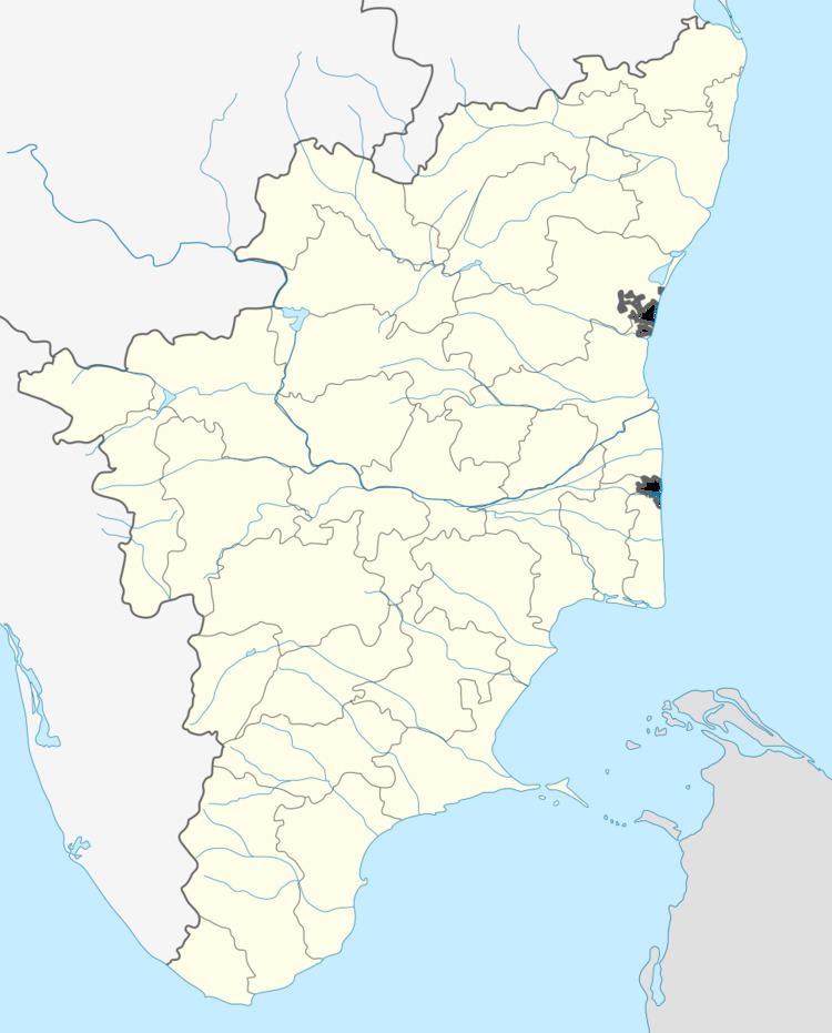
- Map of Lalpet Tamil Nadu 608303
- Population
- Migration
- People
- Education
- Geography
- Nature
- Climate
- Agriculture
- Language
- Religion
- Mosque
- Lalpet sister cities
- Areas Under Lalpet
- Neighborhood towns and villages
- Distance to Cities from lalpet
- Nearby Tourist Places
- Culture
- Dress
- Religious festivals
- References
Map of Lalpet, Tamil Nadu 608303
Population
Out of a population of 50,000 people, Muslims constitute 97%. Remaining 3% are Hindus and Christians.
As per Census report, the total population of Lalpet is Approximately 50,197. Male constitute 50% of the population and 50% are Female. 13% are under 13 age.
Migration
History says that some early group of some family Ethnicity people from Middle East migrated to Lalpet and some other Villages around Lalpet. their ancestry to Arab and Persian traders mostly from Saudi Arabia,Yemen, Oman, Iran and some from Egypt who settled in Lalpet. And later some South East Asians Such as Vietnamese Evacuated to Lalpet while in the time of War at Vietnam.According to this case people are Miscegenation.
Unverified sources suggest that around 12th century AD in Arab countries there was a dispute among two kings who belonged to the same royal family which later erupted in war. The defeated members of the royal family were packed in ships and banished with their captains and servants. Those who settled in Lalpet and coastal regions of south India [Tamil Nadu and Kerala] are called Marakkars. The word Marakkar is usually derived from the Arabic ‘Markab’, a boat.
Labbay is large community in Lalpet. Labbays are said to have descended from traders who originated in the Persian Gulf,[1]. Since the late 13th century, Labbays specialized in the trade and manufacture of leather, tobacco, grains and spices from as far away as China and Southeast Asia. The community's name is derived from the Arabic phrase Labbay'k (Arabic: لبیک), which translates to "here I am."
People
People are identifiable and bonded only by a common language and religion. Otherwise, they belong to multiple ethnic backgrounds such as Arabian, Persian, Dravidian, Aryan, Oriental, Semitic, etc. Hence, their complexions range from fair to dark; facial bone structures range from sharp/oval to rounded. This was due to the frequent trading and miscegenation in South Asia. These races, by the 20th century, began to be listed as social classes in official gazettes of different nations as Lebbai, Marakayar, Rowther, and Dakhini(Deccani).
The majority of the locals work in Abroad while many of the youths do business in the Middle East, Europe and South East Asia. The 30% of Locals has Citizenship in other countries such UK,France,Maldives,Singapore,Malaysia,Brunei,Hong Kong,Laos and US. It shows that people of lalpet was spread all over the world. Other peoples are involved in Business in and around Lalpet. The colonial era the British successively colonized the area.
Education
The total literacy rate of Lalpet is 89% which is more than the national literacy rate. Imam Gazzali School is the Biggest School in Lalpet and Cuddalore district which has over 6000 Students. There are not only many Graduates are present in the town but also many Male and Female Graduates are to come in coming years. There was a Government High School that was started is 1960's which educate students from the town and its surrounding villages. An Association called MUSLIM GRADUATES EDUCATIONAL SOCIETY was Founded in 1991 by the graduates in the town to educate Muslim students. They started a school named IMAM GAZZALI Matric Hr Sec SCHOOL IN 1991.The school was then Promoted to Matriculation school.Now, the school has three wings for Boys,Girls and Kids also. Moreover there are many private schools like Imam Buhari Nursery & Primary School, J.H (Jawamiul Hikam) Nursery & Primary School, Rahmath Nursery & Primary School, Iqra Nursery & Primary School, Saliheen academy Nursery & Primary School, Faizul Irfan Nursery & Primary School, Al Madina Nursery & Primary School, Jiya Nursery & Primary School, This will show the society about the interest of people of Lalpet about Education.
Lalpet is famous for its own heritage and moral values. Arabic college "Jamia Manba'ul Anwar" was established in 1862. This college is said to be the second largest in Tamil Nadu after the famed Baki'aathus Salihaath of Vellore.
Geography
Lalpet is covering approximately a land measurement of Total area: 16.4 km² (6.33 mi²) and Total distance: 18.19 km (11.3 mi²). Lalpet Commune consists of 1 Census Town and 8 Panchayat Villages.
Lalpet Commune wards: Lalpet-Town, Kollumedu-Village, Maniyam Adoor-Village,Kolitheru-Village,Elleri-Village,Vadakkukolkudi-Village,Kangiruppu-Village,JH Nagar-Village and Nathamalai-Village.
Where: It lies approximately 20 kilometers from the temple city of Chidambaram and 3 kilometers from the Kattumannarkoil town. Lalpet was Established before in 1775 by Lal Khan.
Land measurement of Lalpet town alone. Total area: 8.22 km² (3.18 mi²) Total distance: 15.4 km (9.57 mi)
Nature
Lake Veeranam, one of the lengthiest lakes in Tamil Nadu which is origin and passes through Lalpet. Any breach of Veeranam during floods affects Lalpet. Around the city has much vegetation. Lalpet is clean and peaceful.
Climate
The temperature ranges from a maximum of 32.7 °C (90.9 °F) to a minimum of 24 °C (75 °F).in Winter maximum 29 °C (84 °F) or minimum 13 °C (55 °F). April to June are the Summer and December to January are the Winter. lalpet receives an average of 10 mm (0.39 in) annually, which is lesser than the state average of 1,008 mm (39.7 in). The South west monsoon, with an onset in June and lasting up to August, brings scanty rainfall. Bulk of the rainfall is received during the North East monsoon in the months of October, November and December. The average number of rainy days ranges from 35-40 every year.[9][10]
Agriculture
The major and Traditional Agriculture is Paan and other major harvesting is Rice, Potatoes,banana, Ladies Finger, Tomato and Sugarcane.
Language
The official languages of Lalpet are Tamil(87%),and Arabic(12.8%). English is used as second language and also in common usage as an official language of India.French (4.9%). French is the adopted language by Lalpet people who has French influence and nationality. Arabic is ancestor's language who came to lalpet earlier from Arabia and they start to speak Tamil while forward generations gradually stopped speak in Arabic and Tamil become mother tongue. Arabic is teaching by Arabic college "Jamia Manba'ul Anwar" in Lalpet. Minority language include Urdu (5.51 per cent as of 2012); at the 2011 census, Tamil was spoken as the first language by 87 per cent of the population followed by Arabic by 12.8 per cent. With a high-school education would generally be bilingual — speaking their own native language, in addition to Arabic & English, with varying fluency.
Religion
Official religion is Islam. <= controversial, not announced by GOI .
97% Islam, 1.5% Christians and 1.5% Hindus
Mosque
Lal Khan built the biggest mosque in Lalpet, Name of this Mosque is called ' Lalkhan Jamia Masjid' it is the very biggest mosque in the district of cuddalore. Approximately 10,000 peoples can do pray a single time.
Lalpet sister cities
Parangipettai,Pondicherry,Kayalpatnam,Kilakarai and Nidur,chennai
Areas Under Lalpet
Maniyam Adur, Kollumedu, Elleri, Kollimalai melbathi, Kollimalai kilpathi,Kangiruppu,Kaikatti,Nathamalai,J.H.Nagar,Vadakkukulakudi,Lalpettai,Koli theru,
Neighborhood towns and villages
KattumannarKoil, Maniyam Adur, Kollumedu, Elleri, Nedunjeri, Ayangudi and nathamalai.
Distance to Cities from lalpet
CHENNAI: Distance: 232.5 km / 144.5 Mi Time: 3 hours 50 mins. PONDICHERRY: Distance: 90 km / 56 Mi Time: 1.30 mins. KUMBAKONAM: Distance: 49.7 km / 30.9 Mi Time: 75 mins. CHIDAMBARAM: Distance: 20 km / 13 Mi Time: 25 mins. ADIRAMPATTINAM: Distance: 124 km / 70 Mi Time: 3 hours. KILAKARAI: Distance: 273 km / 170.56 Mi Time: 5 hours 5 mins. KAYALPATNAM: Distance: 428 km / 220 Mi Time: 6hours 33 mins. CUDDALORE: Distance: 66 km / 16 Mi Time: 1hour 18 mins. PARANGIPETTAI: Distance: 40 km / 10 Mi Time: 48 mins. TRICHY: Distance: 128 km / 50 Mi Time: 2hours 19 mins.
Nearby Tourist Places
1. Pichavaram - 37 km North East of Lalpet -2-3-5 hour boat rides through ManGroves, 2. GangaiKonda Cholapuram - 20 km South West, 3. JayamKonda Cholapuram - 30 km South West, 4. SriMushnam - Artistic Temple - 20 km West of Lalpet, 5. Coloroon Bridge at Meensuruti - 10 km South , 6. Pondicherry - auroville.
Culture
Lalpet is Islamic and Arabian influenced town. Alcoholic beverages are prohibited as are pork products. The culture is mostly similar with Saudi Arabian Culture.
Dress
The religion and customs of Lalpet dictate conservative dress for both men and women. All women are required to wear a black abaya in public which is a long black cloak that covers the arms and legs.
When a lalpet women appears in public, she normally wears a voluminous black cloak called an abayah, a scarf covering her hair and a full face veil. There are varying opinions regarding the wearing of the abayah and the veil; however, lalpet women cover themselves in public and in the presence of men who are not close relatives.
Women's fashions do not stop with the abayah though if you are a male, that is all you are likely to see. Beneath the black cloak, Lalpet women enjoy fashionable clothing and take great pride in their appearance. They enjoy bright colours and lavish material.
All Men Wear Lungi instead of Long Trouser and religious round head cap for head.
Religious festivals
Lalpet is famous for religious Festivals. Muslims unique functions Eid-ul Fitr and Eid-ul Alha are well celebrated by the people of Lalpet.Eid Al-Fitr, Ramadan and Eid Al-Adha. Eid Al-Fitr is celebrated at the end of Ramadan (a month of fasting), and Muslims usually give zakat (charity) on the occasion. Eid Al-Adha is celebrated at the end of Hajj (annual pilgrimage to Mecca), which is one of the five pillars, and Muslims usually sacrifice an animal and distribute its meat among family, friends and the poor. All Islamic holidays follow the lunar calendar, and thus move each year relative to the solar calendar. The Islamic calendar has 12 months and 354 days on a regular year, and 355 days on a leap year.
Along with this, many other functions are celebrated in the town: 1)During Islamic month of Rabiyul AVVAL and Rabiyul AAHIR, the life History of prophet Mohamed(sal) was discussed in Various Mahallas of Lalpet. 2)During Islamic Month of Jamaathul AAHIR, Haddeses collected by Buhari(Ral) was discussed. 3) Every Friday peoples from all over the Lalpet was assemble in JAMIA MASJID for Jumma prayer are Educated with golden words of our Prophet(sal).