
Type crater lake Max. length 4.3 km (2.7 mi) Surface area 4.5 km (1.7 sq mi) Area 4.5 km² Length 4.3 km | Basin countries New Zealand Max. width 1.7 km (1.1 mi) Surface elevation 394 m Mean depth 18 m Width 1.7 km | |
 | ||
Location Bay of Plenty, North Island Similar Lake Tikitapu, Lake Rotorua, Mount Tarawera, Waimangu Volcanic Rift Valley, Government Gardens | ||
Lake rotokakahi
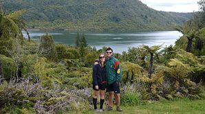
Lake Rotokakahi or Green Lake, is one of four small lakes lying between Lake Rotorua and Lake Tarawera in the Bay of Plenty region of New Zealand's North Island. The others are Lake Tikitapu (Blue Lake), Lake Okareka, and Lake Okataina. All lie within the Okataina caldera, along its western edge.
Contents
- Lake rotokakahi
- Map of Lake Rotokakahi Green Lake Whakarewarewa Rotorua 3074 New Zealand
- Motutawa
- References
Map of Lake Rotokakahi (Green Lake), Whakarewarewa, Rotorua 3074, New Zealand
Named for its abundance of kakahi (freshwater mussels), it flows to Lake Tarawera via the Te Wairoa waterfalls. From the air the lake looks emerald green due to its shallow, sandy bottom. The lake is 1302 feet above sea level and 69 feet below the level of the neighbouring Lake Tikitapu.
Rotokakahi remains under the authority of Te Arawa iwi, Tūhourangi, and remains largely undisturbed as it is considered to be tapu.
Motutawa
This small island in the lake is notable as the site of the 1822 slaughter of a part of Ngāpuhi, that led to the revenge raid of Hongi Hika in 1823—and also as the resting place of the bones of Hinemoa.