
Primary inflows Basin countries New Zealand | Max. depth 82 m (269 ft) Cities Saint Arnaud | |
 | ||
Similar Nelson Lakes National, Lake Rotoroa, Mount Robert, Kahurangi National Park, Saint Arnaud Range | ||
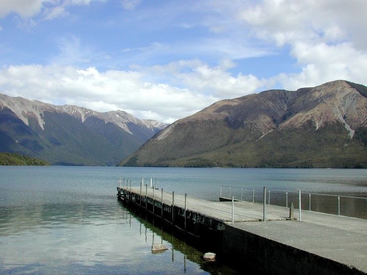
Lake Rotoiti, previously also known as Lake Arthur, is a lake in the Tasman Region of New Zealand. It is a substantial mountain lake within the borders of Nelson Lakes National Park. The lake is fed by the Travers River, water from the lake flows into the Buller River. The lake is surrounded by Beech forest and is 82 metres deep. Saint Arnaud is a small community at the northern end of the lake.
Map of Lake Rotoiti, Tasman District 7072, New Zealand
The first European to see the lake was John Sylvanus Cotterell on 18 January 1843. Thomas Brunner and Charles Heaphy reached the lake in November 1843, and Heaphy named it Lake Arthur after Captain Arthur Wakefield, but the Māori name remained.
Tramping tracks circle the lake, including the Lakehead track on the east side and the Lakeside track on the west side. There is a water taxi service that travels the length of the lake ferrying trampers to and from the Coldwater and Lakehead huts at the head of the lake. Rotoiti is also a popular place for waterskiing and is adjacent to Mt Robert, which hosted a small club-owned skifield, until it was removed by DOC in 2005.
The lake has introduced trout which attract recreational fishermen.