
Length 109 mi (175 km) | Season Year round | |
 | ||
Hazards SunburnHeat strokeAlligatorsPythonsTraffic Surface Asphaltgrassdirtconcrete Similar Lake Okeechobee, John Stretch Park, Karen T Marcus Sandhill, Clewiston Inn, Riverbend Park | ||
Lake okeechobee scenic trail get lost in the palm beaches
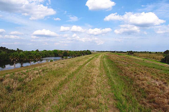
The Lake Okeechobee Scenic Trail (LOST) is a 109 mile multi-use path around Lake Okeechobee,the seventh largest lake in the United States and the largest in the state of Florida. The trail began as the Okeechobee Segment of the Florida National Scenic Trail (FNST), a 1,000 mile trail that runs from Miami to Pensacola. The USDA and National Forest Service dedicated the Okeechobee Segment as part of the FNST in 1993. Most of the trail is atop the 35-feet tall Herbert Hoover Dike. The trail crosses five counties, Hendry, Glades, Okeechobee, Martin and Palm Beach. Many stretches run along state and county highways, including Florida State Road 78.
Contents
- Lake okeechobee scenic trail get lost in the palm beaches
- Map of Lake Okeechobee Scenic Trail Okeechobee FL 34974 USA
- A bike ride on unpaved lake okeechobee scenic trail
- Facilities
- Restrictions
- Closures
- Access points
- References
Map of Lake Okeechobee Scenic Trail, Okeechobee, FL 34974, USA
A bike ride on unpaved lake okeechobee scenic trail
Facilities
There are 13 camping areas around the trail, most of which have no water or sanitation facilities. While the trail circumnavigates the entire lake, there are portions in which the traveler must come down from the levee. In these areas, they may encounter heavy traffic and/or alligators. Because most of the trail runs atop a levee, there is very little shelter from the Florida sun, and running off the edge may result in a dangerous, rapid descent.
Restrictions
Because the trail is administered by the federal government, firearms are prohibited. Groundfires are prohibited, pets must be kept on a leash, and all trash must be carried out.
Closures
Because of the age of the dike and the instability of the terrain, there are frequent partial closures of the trail. A thirty mile section from Mayaca to Canal Point is currently closed for renovation of the levee. Additionally, the portion of the trail running from Taylor Creek to Nubbin Slough section, the portion from Pahokee to Torry Island section, South Bay to Clewiston and Liberty Point to Lakeport section of the Lake Okeechobee Scenic Trail as well as a portion of the Florida National Scenic Trail are closed for extensive dike rehabilitation work. The Corps anticipates some of these sections will remain closed until 2020. The US Army Corps of Engineers maintains the trail and posts information about trail conditions on their website. T
Access points
According to the Corps of Engineers, the following access points are available: