
Type Tidal Extension Surface area 3,069 km (1,185 sq mi) Area 3,069 km² | Basin countries Canada Surface elevation 0 cm | |
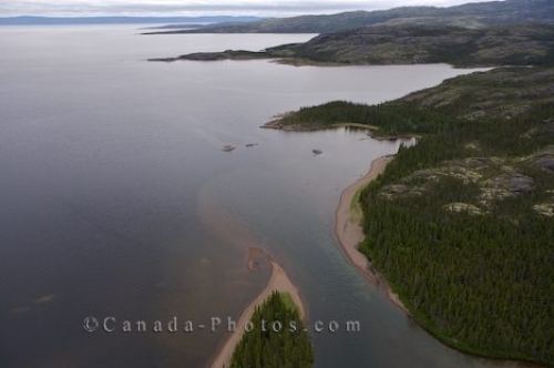 | ||
Seal hunting in lake melville
Lake Melville is a saltwater tidal extension of Hamilton Inlet on the Labrador coast in the Canadian province of Newfoundland and Labrador. Comprising 3,069 square kilometres, and stretching 140 kilometres inland to Happy Valley-Goose Bay, it forms part of the largest estuary in the province, primarily draining the Churchill River and Naskaupi River watersheds. Both Lake Melville and Hamilton Inlet are encircled by mountains, with primary settlements at Happy Valley-Goose Bay, North West River, and Sheshatshiu. A ferry service runs on Lake Melville and Hamilton Inlet, connecting a number communities including Happy Valley-Goose Bay, Rigolet and Cartwright. Lake Melville was named for Viscount Melville (1742–1811), a prominent British politician.
Contents
- Seal hunting in lake melville
- Map of Lake Melville Division No 10 Subd C NL Canada
- Ice fishing trout mulligan lake melville
- GeographyEdit
- HistoryEdit
- References
Map of Lake Melville, Division No. 10, Subd. C, NL, Canada
Ice fishing trout mulligan lake melville
GeographyEdit
Lake Melville it situated in central Labrador. To the south are the Mealy Mountains while another inlet (Double Mer) is located to the north. The Churchill River flows into the southwest point of Lake Melville. Lake Melville extends further inland between the communities of North West River and Sheshatshiu and these extensions are known as "Little Lake" and "Grand Lake". The Naskaupi River flows into Grand Lake.
Lake Melville is served by the Trans-Labrador Highway network. Route 500 spans from the mouth of the Churchill River at Happy Valley-Goose Bay to Labrador West while Route 510 goes from Happy Valley-Goose Bay to Blanc-Sablon where a ferry can be taken to Newfoundland. Route 520 is a paved highway on the west coast of Lake Melville connecting Happy Valley-Goose Bay, Sheshatshiu and North West River. Rigolet and Mud Lake are the only 2 communities in the region that can't be reached by road.
HistoryEdit
The area around Lake Melville was historically inhabited by the Inuit and the Innu. It is believed that Labrador's Inuit migrated to Labrador from Baffin Island in search of Europeans (the Norse are thought to have landed at Baffin Island around 1000 AD). At the end of the Seven Years' War, New France (including Labrador) was ceded to Great Britain. The British decided to develop a cod fishery in Labrador. The fishermen (who mostly came from Newfoundland), often married Inuit women and thus created the "Inuit-Metis". In 1824, the population around Lake Melville was 326 which consisted of 160 Inuit, 60 'half-Inuit', 90 European settlers, and 16 Canadian settlers.
The economy around Lake Melville was historically based around the fishery and fur. Fish and fur prices plummeted with the stock market crash beginning in 1929, weakening the meager though meaningful subsistence-based economy. Construction of an air base at Goose Bay in 1941 and radar installations along the coast offered Southern Inuit their first wage employment. Today, the town of Happy Valley-Goose Bay is one of the largest communities in Labrador and the tenth-largest community in the province of Newfoundland and Labrador.